Langolen | |
|---|---|
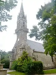 The parish church of Saint-Gunthiern | |
.svg.png.webp) Coat of arms | |
Location of Langolen | |
 Langolen  Langolen | |
| Coordinates: 48°04′04″N 3°54′41″W / 48.0678°N 3.9114°W | |
| Country | France |
| Region | Brittany |
| Department | Finistère |
| Arrondissement | Quimper |
| Canton | Briec |
| Intercommunality | Quimper Bretagne Occidentale |
| Government | |
| • Mayor (2020–2026) | Jean-René Cornic[1] |
| Area 1 | 16.92 km2 (6.53 sq mi) |
| Population | 847 |
| • Density | 50/km2 (130/sq mi) |
| Time zone | UTC+01:00 (CET) |
| • Summer (DST) | UTC+02:00 (CEST) |
| INSEE/Postal code | 29110 /29510 |
| Elevation | 70–208 m (230–682 ft) |
| 1 French Land Register data, which excludes lakes, ponds, glaciers > 1 km2 (0.386 sq mi or 247 acres) and river estuaries. | |
Langolen (French pronunciation: [lɑ̃ɡɔlɛ̃]; Breton: Langolen) is a commune in the Finistère department of Brittany in north-western France.
The commune takes its name from Saint Collen, a 7th-century monk who is associated with the town of Llangollen in Wales and also with Cornwall.
Population
Inhabitants of Langolen are called in French Langolinois.
See also
References
- ↑ "Répertoire national des élus: les maires". data.gouv.fr, Plateforme ouverte des données publiques françaises (in French). 9 August 2021.
- ↑ "Populations légales 2021". The National Institute of Statistics and Economic Studies. 28 December 2023.
External links
Wikimedia Commons has media related to Langolen.
- Official website (in French)
- Base Mérimée: Search for heritage in the commune, Ministère français de la Culture. (in French)
- Mayors of Finistère Association (in French)
This article is issued from Wikipedia. The text is licensed under Creative Commons - Attribution - Sharealike. Additional terms may apply for the media files.