| Lawsons Creek Tributary to Dan River | |
|---|---|
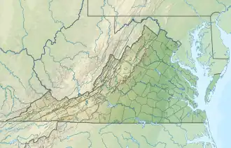 Location of Lawsons Creek mouth  Lawsons Creek (Dan River tributary) (the United States) | |
| Location | |
| Country | United States |
| State | Virginia |
| County | Halifax |
| City | South Boston |
| Physical characteristics | |
| Source | Powells Creek divide |
| • location | about 3 miles northeast of Cunningham, North Carolina |
| • coordinates | 36°33′25″N 079°03′02″W / 36.55694°N 79.05056°W[1] |
| • elevation | 525 ft (160 m)[2] |
| Mouth | |
• location | southwest end of South Boston, Virginia |
• coordinates | 36°41′14″N 078°54′59″W / 36.68722°N 78.91639°W[1] |
• elevation | 320 ft (98 m)[3] |
| Length | 13.44 mi (21.63 km)[4] |
| Basin size | 39.80 square miles (103.1 km2)[5] |
| Discharge | |
| • location | Dan River |
| • average | 46.44 cu ft/s (1.315 m3/s) at mouth with Dan River[5] |
| Basin features | |
| Progression | Dan River → Roanoke River → Albemarle Sound → Pamlico Sound → Atlantic Ocean |
| River system | Roanoke River |
| Tributaries | |
| • left | unnamed tributaries |
| • right | Long Branch Butrum Creek Jerimy Creek Stokes Creek |
| Waterbodies | Wilkins Pond |
| Bridges | Mill Pond Road, Turbeville Road, Cedar Grove Road, US 360 |
Lawsons Creek is a 13.44 mi (21.63 km) long 4th order tributary to the Dan River in Halifax County, Virginia.
Course
Lawsons Creek rises about 3 miles northeast of Cunningham, North Carolina, and then flows northeast to join the Dan River at the southwest side of South Boston.[3]
Watershed
Lawsons Creek drains 39.80 square miles (103.1 km2) of area, receives about 45.7 in/year of precipitation, has a wetness index of 425.97, and is about 43% forested.[5]
See also
References
- 1 2 "Get Maps". USGS Topoview. US Geological Survey. Retrieved 6 September 2021.
- ↑ "Get Maps". USGS Topoview. US Geological Survey. Retrieved 6 September 2021.
- 1 2 "Get Maps". USGS Topoview. US Geological Survey. Retrieved 6 September 2021.
- ↑ "ArcGIS Web Application". epa.maps.arcgis.com. US EPA. Retrieved 6 September 2021.
- 1 2 3 "Lawsons Creek Watershed Report". US EPA Geoviewer. US EPA. Retrieved 6 September 2021.
Watershed Maps
_in_Halifax_County%252C_Virginia%252C_USA.jpg.webp)
Course of Lawsons Creek (Dan River tributary) in Halifax County, Virginia, USA
_in_Halifax_County%252C_Virginia%252C_USA.jpg.webp)
Watershed of Lawsons Creek (Dan River tributary) in Halifax County, Virginia, USA
This article is issued from Wikipedia. The text is licensed under Creative Commons - Attribution - Sharealike. Additional terms may apply for the media files.