Le Mesnil-Raoult | |
|---|---|
Part of Condé-sur-Vire | |
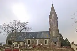 The church of Notre-Dame | |
Location of Le Mesnil-Raoult | |
 Le Mesnil-Raoult  Le Mesnil-Raoult | |
| Coordinates: 49°02′07″N 1°03′33″W / 49.0353°N 1.0592°W | |
| Country | France |
| Region | Normandy |
| Department | Manche |
| Arrondissement | Saint-Lô |
| Canton | Condé-sur-Vire |
| Commune | Condé-sur-Vire |
| Area 1 | 3.98 km2 (1.54 sq mi) |
| Population (2018)[1] | 367 |
| • Density | 92/km2 (240/sq mi) |
| Demonym | Mesnilrodins |
| Time zone | UTC+01:00 (CET) |
| • Summer (DST) | UTC+02:00 (CEST) |
| Postal code | 50420 |
| Elevation | 19–122 m (62–400 ft) (avg. 85 m or 279 ft) |
| 1 French Land Register data, which excludes lakes, ponds, glaciers > 1 km2 (0.386 sq mi or 247 acres) and river estuaries. | |
Le Mesnil-Raoult (French pronunciation: [lə mɛni(l) ʁaul]) is a former commune in the Manche department in Normandy in north-western France. On 1 January 2016, it was merged into the commune of Condé-sur-Vire.[2]
See also
References
- ↑ Téléchargement du fichier d'ensemble des populations légales en 2018, INSEE
- ↑ Arrêté préfectoral 28 September 2015 (in French)
Wikimedia Commons has media related to Le Mesnil-Raoult.
This article is issued from Wikipedia. The text is licensed under Creative Commons - Attribution - Sharealike. Additional terms may apply for the media files.