Leming, Texas | |
|---|---|
| Coordinates: 29°4′6″N 98°28′20″W / 29.06833°N 98.47222°W | |
| Country | United States |
| State | Texas |
| County | Atascosa |
| Area | |
| • Total | 4.8 sq mi (12 km2) |
| • Land | 4.8 sq mi (12 km2) |
| • Water | 0.0 sq mi (0 km2) |
| Elevation | 472 ft (144 m) |
| Population (2010) | |
| • Total | 946 |
| • Density | 200/sq mi (76/km2) |
| Time zone | UTC-6 (Central (CST)) |
| • Summer (DST) | UTC-5 (CDT) |
| Zip Code | 78050, 78064 |
| FIPS code | 48-42256 |
| GNIS feature ID | 1361075[1] |
Leming is an unincorporated community and census-designated place in Atascosa County, Texas, United States. As of the 2010 census, it had a population of 946.[2] This was a new CDP for the 2010 census.[3] The community is part of the San Antonio Metropolitan Statistical Area. Leming has a post office, with the ZIP code 78050.[4]
Geography
Leming is located at 29°4′6″N 98°28′20″W / 29.06833°N 98.47222°W (29.068341, -98.472227). According to the United States Census Bureau, the CDP has a total area of 4.8 square miles (12 km2), all land.[5]
References
- 1 2 U.S. Geological Survey Geographic Names Information System: Leming, Texas
- ↑ "Geographic Identifiers: 2010 Demographic Profile Data (G001): Leming CDP, Texas". U.S. Census Bureau, American Factfinder. Archived from the original on February 10, 2020. Retrieved August 26, 2013.
- ↑ "Population and Housing Unit Counts, 2010 Census of Population and Housing" (PDF). Texas: 2010. Retrieved January 11, 2017.
- ↑ Zip Code Lookup
- ↑ "US Gazetteer Files 2016-Places-Texas". US Census. Archived from the original on August 1, 2019. Retrieved January 11, 2017.
Municipalities and communities of Atascosa County, Texas, United States | ||
|---|---|---|
| Cities | 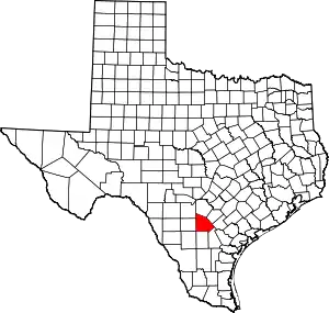 Atascosa County map | |
| Town | ||
| CDP | ||
| Other communities | ||
| Ghost towns | ||
| Footnotes | ‡This populated place also has portions in an adjacent county or counties | |
29°04′23″N 98°29′03″W / 29.07306°N 98.48417°W
This article is issued from Wikipedia. The text is licensed under Creative Commons - Attribution - Sharealike. Additional terms may apply for the media files.