Li County
理县 · ལིས་རྫོང་། · Bez Lixian | |
|---|---|
 Bailong Waterfall in Bipenggou, Li County | |
.png.webp) Li County (red) in Ngawa Prefecture (yellow) and Sichuan province | |
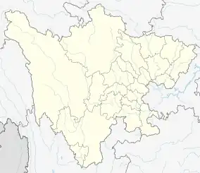 Li County Location of the seat in Sichuan 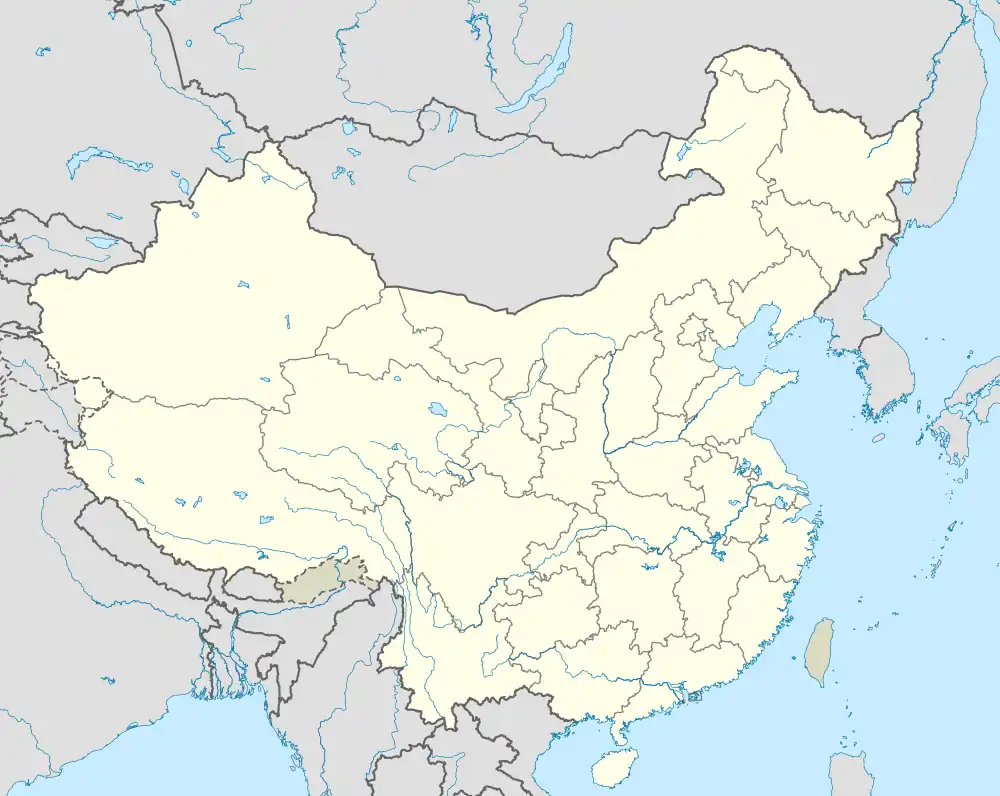 Li County Li County (China) | |
| Coordinates (Li County government): 31°26′09″N 103°09′48″E / 31.4358°N 103.1633°E | |
| Country | China |
| Province | Sichuan |
| Autonomous prefecture | Ngawa |
| County seat | Zhaxiling (Zagunao) |
| Area | |
| • Total | 4,318 km2 (1,667 sq mi) |
| Population (2020)[1] | |
| • Total | 36,926 |
| • Density | 8.6/km2 (22/sq mi) |
| • Major nationalities | Tibetan - 53.43% Qiang - 33.50% Han - 12.46% Hui - 0.41% |
| Time zone | UTC+8 (China Standard) |
| Website | www |
| Li County, Sichuan | |||||||
|---|---|---|---|---|---|---|---|
| Chinese name | |||||||
| Simplified Chinese | 理县 | ||||||
| Traditional Chinese | 理縣 | ||||||
| |||||||
| Tibetan name | |||||||
| Tibetan | ལིས་རྫོང་། | ||||||
| |||||||
| Qiang name | |||||||
| Qiang | Bez | ||||||
Li County or Lixian (Chinese: 理县; Tibetan: ལིས་རྫོང་།; Qiang: pauɕuq), formerly known as Lifan (理番), is a county in Ngawa Tibetan and Qiang Autonomous Prefecture, Sichuan, China. China National Highway G317 and the Zhaxiling River run through the whole territory.[2]
On May 12, 2008, the area was affected by the 2008 Sichuan earthquake.
Geography
Li County is located from 30°54′43″N 102°32′46″E / 30.91194°N 102.54611°E (30.911944°, 102.546111°) to 31°12′12″N 103°30′30″E / 31.20333°N 103.50833°E (31.203333°, 103.508333°).[2]
Climate
| Climate data for Lixian (1991–2020 normals, extremes 1981–2010) | |||||||||||||
|---|---|---|---|---|---|---|---|---|---|---|---|---|---|
| Month | Jan | Feb | Mar | Apr | May | Jun | Jul | Aug | Sep | Oct | Nov | Dec | Year |
| Record high °C (°F) | 20.9 (69.6) |
30.4 (86.7) |
31.7 (89.1) |
32.0 (89.6) |
33.4 (92.1) |
34.6 (94.3) |
35.8 (96.4) |
34.4 (93.9) |
33.6 (92.5) |
27.6 (81.7) |
24.4 (75.9) |
19.5 (67.1) |
35.8 (96.4) |
| Mean daily maximum °C (°F) | 6.8 (44.2) |
10.8 (51.4) |
15.4 (59.7) |
20.6 (69.1) |
23.1 (73.6) |
24.8 (76.6) |
27.3 (81.1) |
27.5 (81.5) |
23.2 (73.8) |
18.2 (64.8) |
13.4 (56.1) |
8.1 (46.6) |
18.3 (64.9) |
| Daily mean °C (°F) | 1.0 (33.8) |
3.9 (39.0) |
8.1 (46.6) |
12.7 (54.9) |
15.8 (60.4) |
18.2 (64.8) |
20.6 (69.1) |
20.6 (69.1) |
17.1 (62.8) |
12.3 (54.1) |
7.2 (45.0) |
2.2 (36.0) |
11.6 (53.0) |
| Mean daily minimum °C (°F) | −3.1 (26.4) |
−0.5 (31.1) |
3.3 (37.9) |
7.4 (45.3) |
10.8 (51.4) |
13.9 (57.0) |
16.1 (61.0) |
16.1 (61.0) |
13.3 (55.9) |
8.7 (47.7) |
3.2 (37.8) |
−1.8 (28.8) |
7.3 (45.1) |
| Record low °C (°F) | −11.0 (12.2) |
−10.9 (12.4) |
−7.9 (17.8) |
−0.5 (31.1) |
3.2 (37.8) |
7.2 (45.0) |
9.3 (48.7) |
7.4 (45.3) |
5.2 (41.4) |
−0.2 (31.6) |
−5.3 (22.5) |
−12.1 (10.2) |
−12.1 (10.2) |
| Average precipitation mm (inches) | 7.5 (0.30) |
12.4 (0.49) |
34.1 (1.34) |
62.2 (2.45) |
96.8 (3.81) |
108.1 (4.26) |
76.2 (3.00) |
68.8 (2.71) |
78.3 (3.08) |
63.2 (2.49) |
15.2 (0.60) |
4.1 (0.16) |
626.9 (24.69) |
| Average precipitation days (≥ 0.1 mm) | 6.8 | 8.3 | 13.0 | 16.9 | 19.6 | 21.0 | 17.0 | 15.0 | 16.8 | 16.4 | 7.3 | 3.9 | 162 |
| Average snowy days | 12.2 | 11.1 | 6.3 | 0.3 | 0 | 0 | 0 | 0 | 0 | 0 | 2.1 | 7.1 | 39.1 |
| Average relative humidity (%) | 62 | 61 | 62 | 63 | 67 | 73 | 72 | 69 | 73 | 73 | 69 | 64 | 67 |
| Mean monthly sunshine hours | 80.7 | 130.5 | 162.7 | 174.8 | 170.9 | 136.8 | 158.3 | 164.5 | 128.8 | 121.7 | 87.2 | 67.7 | 1,584.6 |
| Percent possible sunshine | 25 | 41 | 44 | 45 | 40 | 32 | 37 | 40 | 35 | 35 | 28 | 22 | 35 |
| Source: China Meteorological Administration[3][4] | |||||||||||||
Administrative divisions
Li County oversees 6 towns and 5 townships.[5][6][note 1]The county government is seated in the town of Zhaxiling.[7]
| Name | Simplified Chinese | Hanyu Pinyin | Tibetan | Wylie | Qiang | Administrative division code | |
|---|---|---|---|---|---|---|---|
| Towns | |||||||
| Zhaxiling Town (Zagunao) |
杂谷脑镇 | Zágǔnǎo Zhèn | བཀྲ་ཤིས་གླིང་གྲོང་རྡལ། | bkra shis gling grong rdal | Bawxiaen | 513222100 | |
| Nyaglo Town (Zagunao) |
米亚罗镇 | Mǐyàluó Zhèn | མྱག་ལོ་ཀྲེན། | myag lo kren | Miyalo | 513222101 | |
| Gubrago Town (Gu'ergou) |
古尔沟镇 | Gǔ'ěrgōu Zhèn | ཀུབ་ར་མགོ་གྲོང་རྡལ། | kub ra mgo grong rdal | Guergeu | 513222102 | |
| Xuecheng Town (Xüchêng) |
薛城镇 | Xuēchéng Zhèn | ཞུའེ་ཁྲེང་ཀྲེན་། | zhuve khreng kren | 513222103 | ||
| Taoping Town | 桃坪镇 | Táopíng Zhèn | ཐའོ་ཕིང་གྲོང་རྡལ། | thavo phing grong rdal | Saqi | 513222104 | |
| Putou Town (Püdü) |
朴头镇 | Pǔtóu Zhèn | ཕུའི་འཏུའི་གྲོང་རྡལ། | phuvi vtuvi grong rdal | 513222105 | ||
| Townships | |||||||
| Ganbao Township (Gainpu) |
甘堡乡 | Gānbǎo Xiāng | ཀམ་ཕུ་ཡུལ་ཚོ། | kam phu yul tsho | 513222202 | ||
| Puxi Township (Puqi) |
蒲溪乡 | Púxī Xiāng | ཕུའུ་ཆི་ཡུལ་ཚོ། | phuvu chi yul tsho | 513222203 | ||
| Bodogxugo Township (Shangmeng) |
上孟乡 | Shàngmèng Xiāng | འབོ་ཏོག་ཤུ་ཀོ་ཡུལ་ཚོ། | vbo tog shu ko yul tsho | 513222204 | ||
| Bodogxudo Township (Xiameng) |
下孟乡 | Xiàmèng Xiāng | འབོ་ཏོག་ཤུ་ཏོ་ཡུལ་ཚོ། | vbo tog shu to yul tsho | 513222205 | ||
| Tonghua Township | 通化乡 | Tōnghuà Xiāng | ཐོང་ཧྭ་ཞང་། | thong hwa zhang | 513222207 | ||
Demographics
As of 2018, Li County had a registered population of 43,375.[8] 11,706 of the county's population, or 27%, is urbanized.[8]
The county had a population of 42,494 in 1999.[9]
Ethnic groups
| Ethnicity | Population | Percentage |
|---|---|---|
| Tibetan | 23,175 | 53.43% |
| Qiang | 14,531 | 33.50% |
| Han | 5,405 | 12.46% |
| Hui | 179 | 0.41% |
| Other | 85 | 0.20% |
Transport
Notes
- ↑ The former source (stats.gov.cn) indicates 6 towns and 7 townships as of the start of 2019, whereas the latter source (sc.gov.cn) documents a decree passed in December 2019 revoking 1 of the 7 townships, bringing the number down to 6.
- ↑ "阿坝州第七次全国人口普查公报第二号——县(市)人口情况" (in Chinese). Government of Ngawa Prefecture. 2021-06-11.
- 1 2 abazhou.gov.cn Archived 2008-05-01 at the Wayback Machine
- ↑ 中国气象数据网 – WeatherBk Data (in Simplified Chinese). China Meteorological Administration. Retrieved 13 April 2023.
- ↑ 中国气象数据网 (in Simplified Chinese). China Meteorological Administration. Retrieved 13 April 2023.
- ↑ 2019年统计用区划代码. www.stats.gov.cn (in Chinese). 2019. Archived from the original on 2020-07-06. Retrieved 2020-07-06.
- ↑ 四川省人民政府关于同意阿坝州调整马尔康市等10个县(市)部分乡镇行政区划的批复(川府民政〔2019〕22号). sc.gov.cn (in Chinese). 2019-12-20. Archived from the original on 2020-07-06. Retrieved 2020-07-06.
- 1 2 理县概况地图. xzqh.org (in Chinese). 2015-12-17. Archived from the original on 2017-09-21. Retrieved 2020-07-06.
- 1 2 3 人口民族. Li County People's Government (in Chinese). 2019-11-27. Archived from the original on 2020-07-06. Retrieved 2020-07-06.
- ↑ (in English) National Population Statistics Materials by County and City - 1999 Period, in China County & City Population 1999, Harvard China Historical GIS
External links
- (in Chinese) New County Government Website
- (in Chinese) Old County Government Website - Google translation
- (in Chinese) Li County (bashu.net) - Google translation