| Little Richardson Creek Tributary to Richardson Creek | |
|---|---|
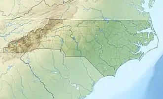 Location of Little Richardson Creek mouth  Little Richardson Creek (the United States) | |
| Location | |
| Country | United States |
| State | North Carolina |
| County | Union |
| City | Monroe |
| Physical characteristics | |
| Source | Buffalo Creek divide |
| • location | about 1 mile southeast of Alton, North Carolina |
| • coordinates | 34°52′43″N 080°31′18″W / 34.87861°N 80.52167°W[1] |
| • elevation | 648 ft (198 m)[2] |
| Mouth | Richardson Creek |
• location | Lake Lee southeast of Monroe, North Carolina |
• coordinates | 34°57′46″N 080°30′44″W / 34.96278°N 80.51222°W[1] |
• elevation | 490 ft (150 m)[2] |
| Length | 6.39 mi (10.28 km)[3] |
| Basin size | 16.46 square miles (42.6 km2)[4] |
| Discharge | |
| • location | Richardson Creek |
| • average | 19.52 cu ft/s (0.553 m3/s) at mouth with Richardson Creek[4] |
| Basin features | |
| Progression | Richardson Creek → Rocky River → Pee Dee River → Winyah Bay → Atlantic Ocean |
| River system | Pee Dee |
| Tributaries | |
| • left | unnamed tributaries |
| • right | Buck Branch |
| Waterbodies | Lake Monroe Lake Lee |
| Bridges | Bruce Thomas Road, E Sandy Ridge Road (x2), Stack Road, Macedonia Church Road, Medlin Road |
Little Richardson Creek is a 6.39 mi (10.28 km) long 3rd order tributary to Richardson Creek in Union County, North Carolina.
Course
Little Richardson Creek rises about 1 mile southeast of Alton, North Carolina and then flows north to join Richardson Creek in Lake Lee southeast of Monroe, North Carolina.[2]
Watershed
Little Richardson Creek drains 16.46 square miles (42.6 km2) of area, receives about 48.6 in/year of precipitation, has a wetness index of 447.78, and is about 41% forested.[4]
References
- 1 2 "GNIS Detail - Little Richardson Creek". geonames.usgs.gov. Locality, LLC. Retrieved 13 October 2020.
- 1 2 3 "Little Richardson Creek Topo Map in Union". TopoZone. Locality, LLC. Retrieved 13 October 2020.
- ↑ "ArcGIS Web Application". epa.maps.arcgis.com. US EPA. Retrieved 13 October 2020.
- 1 2 3 "Watershed Report | Office of Water | US EPA". watersgeo.epa.gov. US EPA. Retrieved 13 October 2020.
This article is issued from Wikipedia. The text is licensed under Creative Commons - Attribution - Sharealike. Additional terms may apply for the media files.