Lowes, Kentucky | |
|---|---|
 | |
| Coordinates: 36°53′08″N 88°46′26″W / 36.88556°N 88.77389°W | |
| Country | United States |
| State | Kentucky |
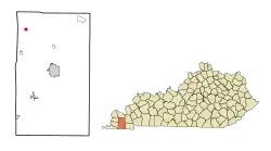
| County | Graves |
| Area | |
| • Total | 0.69 sq mi (1.78 km2) |
| • Land | 0.69 sq mi (1.77 km2) |
| • Water | 0.00 sq mi (0.00 km2) |
| Elevation | 469 ft (143 m) |
| Population (2020) | |
| • Total | 92 |
| • Density | 134.31/sq mi (51.84/km2) |
| Time zone | UTC-6 (Central (CST)) |
| • Summer (DST) | UTC-5 (CDT) |
| Area code(s) | 270 & 364 |
| GNIS feature ID | 497318[2] |
Lowes is an unincorporated community and census-designated place (CDP) in Graves County, Kentucky, United States.[3] Lowes is 13 miles (21 km) northwest of Mayfield. As of the 2010 Census the population of Lowes was 98.[4]
Demographics
| Census | Pop. | Note | %± |
|---|---|---|---|
| 2020 | 92 | — | |
| U.S. Decennial Census[5] | |||
Notable people
- Alben W. Barkley, U.S. Senator and Vice President of the United States, born near Lowes
- J. Paul Hogan, pioneer in the invention of the plastics industry, born in Lowes
References
- ↑ "2020 U.S. Gazetteer Files". United States Census Bureau. Retrieved March 18, 2022.
- ↑ "US Board on Geographic Names". United States Geological Survey. October 25, 2007. Retrieved January 31, 2008.
- ↑ "Feature Detail Report for: Lowes, Kentucky." United States Geological Survey. U.S. Geological Survey Geographic Names Information System: Lowes, Kentucky Retrieved May 11, 2011.
- ↑ "Geographic Identifiers: 2010 Demographic Profile Data (G001): Lowes CDP, Kentucky". American Factfinder. U.S. Census Bureau. Retrieved December 12, 2016.
- ↑ "Census of Population and Housing". Census.gov. Retrieved June 4, 2016.
Municipalities and communities of Graves County, Kentucky, United States | ||
|---|---|---|
| Cities | 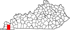 Location of Graves County, Kentucky | |
| CDPs | ||
| Unincorporated communities | ||
| Footnotes | ‡This populated place also has portions in an adjacent county or counties | |
This article is issued from Wikipedia. The text is licensed under Creative Commons - Attribution - Sharealike. Additional terms may apply for the media files.