| Lunain | |
|---|---|
 | |
 | |
| Location | |
| Country | France |
| Physical characteristics | |
| Source | |
| • location | near Égriselles-le-Bocage |
| • coordinates | 48°06′38″N 3°08′45″E / 48.11056°N 3.14583°E |
| • elevation | 185 m (607 ft) |
| Mouth | |
• location | Loing |
• coordinates | 48°20′09″N 2°46′56″E / 48.33583°N 2.78222°E |
• elevation | 50 m (160 ft) |
| Length | 51.4 km (31.9 mi) |
| Basin features | |
| Progression | Loing→ Seine→ English Channel |
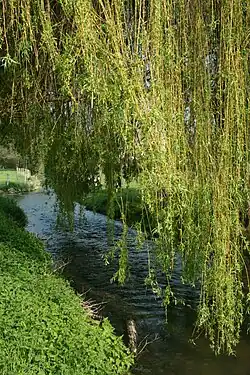
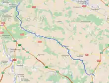
The Lunain (French pronunciation: [lynɛ̃]) is a 51.4 km (31.9 mi) long river in the Yonne and Seine-et-Marne departments in north-central France. It is a right tributary of the Loing.[1] Its source is in Yonne, less than 3 km (1.9 mi) south-west of Égriselles-le-Bocage. It joins the Loing at Épisy in Seine-et-Marne.
Départements and communes it runs through
- Yonne: Égriselles-le-Bocage, Courtoin, La Belliole, Montacher-Villegardin, Chéroy
- Seine-et-Marne: Vaux-sur-Lunain, Lorrez-le-Bocage-Préaux, Paley, Nanteau-sur-Lunain, Treuzy-Levelay, Nonville, La Genevraye, Villemer, Épisy
References
This article is issued from Wikipedia. The text is licensed under Creative Commons - Attribution - Sharealike. Additional terms may apply for the media files.