Luz | |
|---|---|
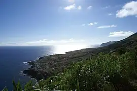 The most southern community in Luz, Carapacho, as seen from the Ponta da Restinga | |
 Coat of arms | |
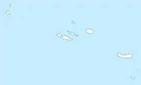 Luz Location in the Azores 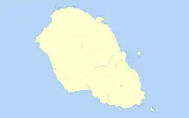 Luz Luz (Graciosa) | |
| Coordinates: 39°1′18″N 27°59′23″W / 39.02167°N 27.98972°W | |
| Country | |
| Auton. region | Azores |
| Island | Graciosa |
| Municipality | Santa Cruz da Graciosa |
| Established | Parish: c.1601 Civil parish: c.1867 |
| Area | |
| • Total | 11.70 km2 (4.52 sq mi) |
| Elevation | 88 m (289 ft) |
| Population (2011) | |
| • Total | 683 |
| • Density | 58/km2 (150/sq mi) |
| Time zone | UTC−01:00 (AZOT) |
| • Summer (DST) | UTC±00:00 (AZOST) |
| Postal code | 9880-154 |
| Area code | 292 |
| Patron | Nossa Senhora de Luz |
| Website | jfluz |
Luz is a civil parish in the municipality of Santa Cruz da Graciosa on the island of Graciosa in the Portuguese Azores. The population in 2011 was 683,[1] in an area of 11.70 km².[2] It contains the localities Alto do Sul, Fajã da Folga, Folga, Carapacho, Luz and Pedras Brancas.
References
- ↑ Instituto Nacional de Estatística
- ↑ Eurostat Archived 2012-10-07 at the Wayback Machine
This article is issued from Wikipedia. The text is licensed under Creative Commons - Attribution - Sharealike. Additional terms may apply for the media files.