Lycan, Colorado | |
|---|---|
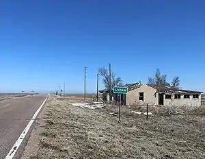 Looking east along State Highway 116 in Lycan. | |
| Coordinates: 37°33′26.94″N 102°07′42.98″W / 37.5574833°N 102.1286056°W | |
| Country |  United States United States |
| State |  Colorado Colorado |
| County | Baca[1] |
| Elevation | 3,865 ft (1,178 m) |
| Time zone | UTC-7 (MST) |
| • Summer (DST) | UTC-6 (MDT) |
| ZIP code[2] | 81084 (Two Buttes) |
| Area code | 719 |
| GNIS feature ID | 0196066 |
Lycan is an unincorporated community in Baca County, Colorado, United States. It is located approximately 37 driving miles east-northeast of Springfield.[3]
History
The U.S. Post Office at Two Buttes (ZIP Code 81084) now serves Lycan postal addresses.[2]
The town is also referred to as Buckeye Crossroads.
Geography
Lycan is located at 37°33′26.94″N 102°07′42.98″W / 37.5574833°N 102.1286056°W (37.55765,-102.128605) at the junction of Colorado highways 89 and 116.[4]
The community is just over 5 miles from the state border with Kansas.[5]
References
- 1 2 "US Board on Geographic Names". United States Geological Survey. October 25, 2007. Retrieved January 31, 2008.
- 1 2 "ZIP Code Lookup". United States Postal Service. January 3, 2007. Archived from the original (JavaScript/HTML) on November 22, 2010. Retrieved January 3, 2007.
- ↑ "Springfield, Colorado to Lycan, Colorado". Google Maps. Retrieved December 10, 2020.
- ↑ "DTD DataAccess - Statistics, Maps and Data - Highways Data". Archived from the original on April 16, 2011. Retrieved February 1, 2011.
- ↑ "Co Rd 57, Holly, CO to Lycan, Colorado". Google Maps. Retrieved December 10, 2020.
Municipalities and communities of Baca County, Colorado, United States | ||
|---|---|---|
| Towns | 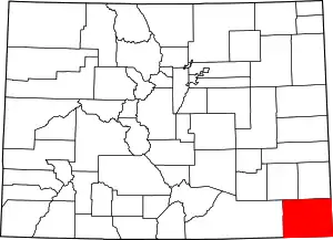 Map of Colorado highlighting Baca County | |
| Unincorporated communities | ||
This article is issued from Wikipedia. The text is licensed under Creative Commons - Attribution - Sharealike. Additional terms may apply for the media files.