MacArthur | |
|---|---|
| Municipality of MacArthur | |
 Flag | |
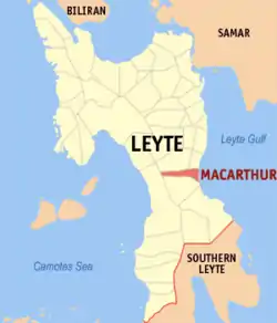 Map of Leyte with MacArthur highlighted | |
OpenStreetMap | |
.svg.png.webp) MacArthur Location within the Philippines | |
| Coordinates: 10°50′08″N 124°59′47″E / 10.8356°N 124.9964°E | |
| Country | Philippines |
| Region | Eastern Visayas |
| Province | Leyte |
| District | 2nd district |
| Named for | Douglas MacArthur |
| Barangays | 31 (see Barangays) |
| Government | |
| • Type | Sangguniang Bayan |
| • Mayor | Rudin T. Babante |
| • Vice Mayor | Rene R. Leria |
| • Representative | Lolita T. Javier |
| • Councilors | List |
| • Electorate | 16,100 voters (2022) |
| Area | |
| • Total | 57.57 km2 (22.23 sq mi) |
| Elevation | 125 m (410 ft) |
| Highest elevation | 1,154 m (3,786 ft) |
| Lowest elevation | 0 m (0 ft) |
| Population (2020 census)[3] | |
| • Total | 21,578 |
| • Density | 370/km2 (970/sq mi) |
| • Households | 5,574 |
| Economy | |
| • Income class | 5th municipal income class |
| • Poverty incidence | 29.64 |
| • Revenue | ₱ 100.2 million (2020) |
| • Assets | ₱ 173.3 million (2020) |
| • Expenditure | ₱ 98.49 million (2020) |
| • Liabilities | ₱ 37.96 million (2020) |
| Service provider | |
| • Electricity | Don Orestes Romualdez Electric Coperative (DORELCO) |
| Time zone | UTC+8 (PST) |
| ZIP code | 6509 |
| PSGC | |
| IDD : area code | +63 (0)53 |
| Native languages | Waray Tagalog |
| Website | www |
MacArthur (IPA: [mək 'ɑːrθər]), officially the Municipality of MacArthur (Waray: Bungto han MacArthur; Tagalog: Bayan ng MacArthur), is a 5th class municipality in the province of Leyte, Philippines. According to the 2020 census, it has a population of 21,578 people.[3]
Geography
Barangays
MacArthur is politically subdivided into 31 barangays. [5] Each barangay consists of puroks and some have sitios.
- Batug
- Burabod
- Capudlosan
- Casuntingan
- Causwagan
- Danao
- General Luna
- Kiling
- Lanawan
- Liwayway
- Maya
- Oguisan
- Osmeña
- Palale 1
- Palale 2
- Poblacion District 1
- Poblacion District 2
- Poblacion District 3
- Pongon
- Quezon
- Romualdez
- Salvacion
- San Antonio
- San Isidro
- San Pedro
- San Vicente
- Santa Isabel
- Tin-awan
- Tuyo
- Doña Josefa
- Villa Imelda
Climate
| Climate data for MacArthur, Leyte | |||||||||||||
|---|---|---|---|---|---|---|---|---|---|---|---|---|---|
| Month | Jan | Feb | Mar | Apr | May | Jun | Jul | Aug | Sep | Oct | Nov | Dec | Year |
| Mean daily maximum °C (°F) | 28 (82) |
29 (84) |
29 (84) |
30 (86) |
30 (86) |
30 (86) |
29 (84) |
29 (84) |
29 (84) |
29 (84) |
29 (84) |
29 (84) |
29 (84) |
| Mean daily minimum °C (°F) | 22 (72) |
22 (72) |
22 (72) |
23 (73) |
25 (77) |
25 (77) |
25 (77) |
25 (77) |
25 (77) |
24 (75) |
24 (75) |
23 (73) |
24 (75) |
| Average precipitation mm (inches) | 78 (3.1) |
57 (2.2) |
84 (3.3) |
79 (3.1) |
118 (4.6) |
181 (7.1) |
178 (7.0) |
169 (6.7) |
172 (6.8) |
180 (7.1) |
174 (6.9) |
128 (5.0) |
1,598 (62.9) |
| Average rainy days | 16.7 | 13.8 | 17.3 | 18.5 | 23.2 | 26.5 | 27.1 | 26.0 | 26.4 | 27.5 | 24.6 | 21.0 | 268.6 |
| Source: Meteoblue[6] | |||||||||||||
Demographics
| Year | Pop. | ±% p.a. |
|---|---|---|
| 1960 | 10,647 | — |
| 1970 | 11,486 | +0.76% |
| 1975 | 12,433 | +1.60% |
| 1980 | 12,780 | +0.55% |
| 1990 | 13,159 | +0.29% |
| 1995 | 16,645 | +4.50% |
| 2000 | 16,844 | +0.26% |
| 2007 | 17,608 | +0.61% |
| 2010 | 18,724 | +2.26% |
| 2015 | 21,211 | +2.40% |
| 2020 | 21,578 | +0.34% |
| Source: Philippine Statistics Authority [7][8][9][10] | ||
In the 2020 census, the population of MacArthur, Leyte, was 21,578 people,[3] with a density of 370 inhabitants per square kilometre or 960 inhabitants per square mile.
Economy
References
- ↑ Municipality of MacArthur | (DILG)
- ↑ "2015 Census of Population, Report No. 3 – Population, Land Area, and Population Density" (PDF). Philippine Statistics Authority. Quezon City, Philippines. August 2016. ISSN 0117-1453. Archived (PDF) from the original on May 25, 2021. Retrieved July 16, 2021.
- 1 2 3 Census of Population (2020). "Region VIII (Eastern Visayas)". Total Population by Province, City, Municipality and Barangay. Philippine Statistics Authority. Retrieved 8 July 2021.
- ↑ "PSA Releases the 2018 Municipal and City Level Poverty Estimates". Philippine Statistics Authority. 15 December 2021. Retrieved 22 January 2022.
- ↑ "Province:". PSGC Interactive. Quezon City, Philippines: Philippine Statistics Authority. Retrieved 12 November 2016.
- ↑ "MacArthur: Average Temperatures and Rainfall". Meteoblue. Retrieved 29 February 2020.
- ↑ Census of Population (2015). "Region VIII (Eastern Visayas)". Total Population by Province, City, Municipality and Barangay. Philippine Statistics Authority. Retrieved 20 June 2016.
- ↑ Census of Population and Housing (2010). "Region VIII (Eastern Visayas)" (PDF). Total Population by Province, City, Municipality and Barangay. National Statistics Office. Retrieved 29 June 2016.
- ↑ Censuses of Population (1903–2007). "Region VIII (Eastern Visayas)". Table 1. Population Enumerated in Various Censuses by Province/Highly Urbanized City: 1903 to 2007. National Statistics Office.
{{cite encyclopedia}}: CS1 maint: numeric names: authors list (link) - ↑ "Province of". Municipality Population Data. Local Water Utilities Administration Research Division. Retrieved 17 December 2016.
- ↑ "Poverty incidence (PI):". Philippine Statistics Authority. Retrieved December 28, 2020.
- ↑ "Estimation of Local Poverty in the Philippines" (PDF). Philippine Statistics Authority. 29 November 2005.
- ↑ "2003 City and Municipal Level Poverty Estimates" (PDF). Philippine Statistics Authority. 23 March 2009.
- ↑ "City and Municipal Level Poverty Estimates; 2006 and 2009" (PDF). Philippine Statistics Authority. 3 August 2012.
- ↑ "2012 Municipal and City Level Poverty Estimates" (PDF). Philippine Statistics Authority. 31 May 2016.
- ↑ "Municipal and City Level Small Area Poverty Estimates; 2009, 2012 and 2015". Philippine Statistics Authority. 10 July 2019.
- ↑ "PSA Releases the 2018 Municipal and City Level Poverty Estimates". Philippine Statistics Authority. 15 December 2021. Retrieved 22 January 2022.
External links
- Philippine Standard Geographic Code
- Philippine Census Information
- Local Governance Performance Management System
Places adjacent to MacArthur, Leyte | ||||||||||||||||
|---|---|---|---|---|---|---|---|---|---|---|---|---|---|---|---|---|
| ||||||||||||||||
Tacloban (capital and largest city) | |
| Municipalities |
|
| Component city | |
| Independent component city |
|
| Highly urbanized city |
|
This article is issued from Wikipedia. The text is licensed under Creative Commons - Attribution - Sharealike. Additional terms may apply for the media files.