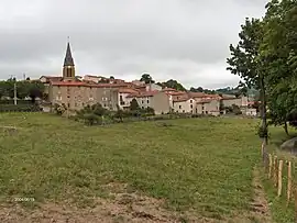
Machézal | |
|---|---|
Commune | |
 | |
Location of Machézal | |
 Machézal  Machézal | |
| Coordinates: 45°55′21″N 4°18′11″E / 45.9225°N 4.3031°E | |
| Country | France |
| Region | Auvergne-Rhône-Alpes |
| Department | Loire |
| Arrondissement | Roanne |
| Canton | Le Coteau |
| Intercommunality | Pays entre Loire et Rhône |
| Government | |
| • Mayor (2020–2026) | Béatrice Fournel[1] |
| Area 1 | 13.88 km2 (5.36 sq mi) |
| Population | 398 |
| • Density | 29/km2 (74/sq mi) |
| Time zone | UTC+01:00 (CET) |
| • Summer (DST) | UTC+02:00 (CEST) |
| INSEE/Postal code | 42128 /42114 |
| Elevation | 470–882 m (1,542–2,894 ft) (avg. 625 m or 2,051 ft) |
| 1 French Land Register data, which excludes lakes, ponds, glaciers > 1 km2 (0.386 sq mi or 247 acres) and river estuaries. | |
Machézal (French pronunciation: [maʃezal]; Arpitan: Mont-Chesâl) is a commune in the Loire department in central France.
Population
| Year | Pop. | ±% p.a. |
|---|---|---|
| 1968 | 353 | — |
| 1975 | 323 | −1.26% |
| 1982 | 315 | −0.36% |
| 1990 | 306 | −0.36% |
| 1999 | 361 | +1.85% |
| 2007 | 407 | +1.51% |
| 2012 | 416 | +0.44% |
| 2017 | 382 | −1.69% |
| Source: INSEE[3] | ||
See also
References
- ↑ "Répertoire national des élus: les maires". data.gouv.fr, Plateforme ouverte des données publiques françaises (in French). 2 December 2020.
- ↑ "Populations légales 2021". The National Institute of Statistics and Economic Studies. 28 December 2023.
- ↑ Population en historique depuis 1968, INSEE
Wikimedia Commons has media related to Machézal.
This article is issued from Wikipedia. The text is licensed under Creative Commons - Attribution - Sharealike. Additional terms may apply for the media files.