Machairado
Μαχαιράδο | |
|---|---|
 Machairado | |
| Coordinates: 37°45.5′N 20°48.6′E / 37.7583°N 20.8100°E | |
| Country | Greece |
| Administrative region | Ionian Islands |
| Regional unit | Zakynthos |
| Municipality | Zakynthos |
| Municipal unit | Artemisia |
| Community | |
| • Population | 941 (2011) |
| Time zone | UTC+2 (EET) |
| • Summer (DST) | UTC+3 (EEST) |
| Vehicle registration | ZA |
Machairado Zakynthos.jpg
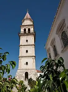
Machairado (Greek: Μαχαιράδο) is a village in the central part of the island of Zakynthos, Greece. It was the seat of the municipality of Artemisia. In 2011 its population was 941.[1] It is situated at the foot of low mountains, 1 km north of Lagopodo, 3 km northeast of Koiliomenos and 8 km southwest of Zakynthos (city). The village suffered great damage from the 1953 Ionian earthquake.
Population
| Year | Population |
|---|---|
| 1981 | 789 |
| 1991 | 796 |
| 2001 | 925 |
| 2011 | 941 |
See also
References
- 1 2 "Απογραφή Πληθυσμού - Κατοικιών 2011. ΜΟΝΙΜΟΣ Πληθυσμός" (in Greek). Hellenic Statistical Authority.
External links
This article is issued from Wikipedia. The text is licensed under Creative Commons - Attribution - Sharealike. Additional terms may apply for the media files.