Manajanabo | |
|---|---|
Town [1] | |
.png.webp) Manajanabo (red) in Santa Clara (orange) in Villa Clara (yellow) | |
.svg.png.webp) Manajanabo 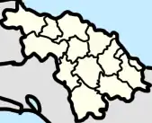 Manajanabo _location_map.png.webp) Manajanabo | |
| Coordinates: 22°23′02″N 79°49′01″W / 22.3839738°N 79.8169152°W | |
| Country | Cuba |
| Province | Villa Clara |
| Municipality | Santa Clara |
| Area | |
| • Total | 0.45 km2 (0.17 sq mi) |
| Population (2012)[2] | |
| • Total | 1,750 |
| • Density | 3,900/km2 (10,000/sq mi) |
| Postal Code | 50100 [3] |
Manajanabo is a town and ward (consejo popular) in Santa Clara, Cuba. Manajanabo lies on the Minerva Lake.
Geography
Manajanabo ward borders Sakenaf, Escambray, Vigía Sandino, Universidad, and Camilo Cienfuegos.[4]
Notable People
- Gerardo Machado, president of Cuba from 1925–33
References
- ↑ "Manajanabo, Villa Clara, Cuba". cu.geoview.info.
- 1 2 "Santa Clara (Municipality, Villa Clara Province, Cuba) - Population Statistics, Charts, Map and Location". www.citypopulation.de.
- ↑ "Manajanabo Villa Clara Postal / ZIP codes and streets list - Getpostalcodes.com". www.getpostalcodes.com.
- ↑ "EVALUACIÓN GEOAMBIENTAL DE LA CIUDAD Y EL MUNICIPIO DE SANTA CLARA, CUBA, PARA EL PERFECCIONAMIENTO DEL SISTEMA DE VIGILANCIA EN SALUD - PDF Descargar libre". docplayer.es. Retrieved 2022-09-11.
This article is issued from Wikipedia. The text is licensed under Creative Commons - Attribution - Sharealike. Additional terms may apply for the media files.