Maple | |
|---|---|
Neighbourhood | |
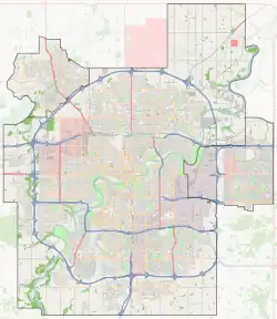 Maple Location of Maple in Edmonton | |
| Coordinates: 53°28′30″N 113°21′00″W / 53.475°N 113.350°W | |
| Country | Canada |
| Province | Alberta |
| City | Edmonton |
| Quadrant[1] | NW |
| Ward[1] | Sspomitapi |
| Sector[2] | Southeast |
| Area[3][4] | The Meadows |
| Government | |
| • Mayor | Amarjeet Sohi |
| • Administrative body | Edmonton City Council |
| • Councillor | Jo-Anne Wright |
| Area | |
| • Total | 1.83 km2 (0.71 sq mi) |
| Elevation | 717 m (2,352 ft) |
| Population (2019)[7] | |
| • Total | 2,517 |
Maple is a neighbourhood in southeast Edmonton, Alberta, Canada that was established in 2010 through the adoption of the Maple Neighbourhood Structure Plan (NSP).[8]
Maple is located within The Meadows area and was originally identified as Neighbourhood 7 within The Meadows Area Structure Plan (ASP).[9]
It is bounded on the west by a Canadian National rail line, north by Whitemud Drive, east by Anthony Henday Drive, and south by The Meadows Neighbourhood 5.[8][9]
Surrounding neighbourhoods
Places adjacent to Maple, Edmonton | ||||||||||||||||
|---|---|---|---|---|---|---|---|---|---|---|---|---|---|---|---|---|
| ||||||||||||||||
References
- 1 2 "City of Edmonton Wards & Standard Neighbourhoods" (PDF). City of Edmonton. Archived from the original (PDF) on May 3, 2014. Retrieved February 13, 2013.
- ↑ "Edmonton Developing and Planned Neighbourhoods, 2011" (PDF). City of Edmonton. Archived from the original (PDF) on September 4, 2013. Retrieved February 13, 2013.
- ↑ "The Way We Grow: Municipal Development Plan Bylaw 15100" (PDF). City of Edmonton. 2010-05-26. Archived from the original (PDF) on May 2, 2015. Retrieved February 13, 2013.
- ↑ "City of Edmonton Plans in Effect" (PDF). City of Edmonton. November 2011. Archived from the original (PDF) on October 17, 2013. Retrieved February 13, 2013.
- ↑ "Mayor and City Council". City of Edmonton. Retrieved December 27, 2023.
- ↑ "City of Edmonton : Neighbourhood Boundaries". City of Edmonton - Open Data. City of Edmonton. Retrieved January 26, 2019.
- ↑ "2019 Municipal Census Results". www.edmonton.ca. City of Edmonton. Retrieved June 11, 2020.
- 1 2 "Maple Crest - Lot Map". Maple Crest. 2021-08-19. Retrieved 2021-08-19.
- 1 2 "The Meadows Area Structure Plan (Office Consolidation)" (PDF). City of Edmonton. June 2010. Archived from the original (PDF) on 2011-06-16. Retrieved 2011-01-29.
This article is issued from Wikipedia. The text is licensed under Creative Commons - Attribution - Sharealike. Additional terms may apply for the media files.