Maplecreek, Washington | |
|---|---|
 Maplecreek | |
| Coordinates: 47°47′16.5″N 120°8′24.3″W / 47.787917°N 120.140083°W | |
| Country | United States |
| State | Washington |
| County | Chelan |
| Elevation | 1,280 ft (390 m) |
| Time zone | UTC-8 (Pacific (PST)) |
| • Summer (DST) | UTC-7 (PDT) |
| ZIP code | 98816 |
| Area code | 509 |
| GNIS feature ID | 1530777[1] |
Maplecreek is an unincorporated community in Chelan County, in the U.S. state of Washington.[2] An alternate route of U.S. Route 97 runs through the community, connecting it with Chelan about 10 miles to the northeast and Entiat about 10 miles to the south.[3]
History
A post office called Maplecreek was established in 1908, and remained in operation until 1918.[4] The community takes its name from nearby Maple Creek.
References
- ↑ U.S. Geological Survey Geographic Names Information System: Maplecreek, Washington
- ↑ U.S. Geological Survey Geographic Names Information System: Maplecreek, Washington
- ↑ "Maplecreek Summary Report". nationalmap.gov. U.S. Geological Survey. Retrieved September 7, 2022.
- ↑ "Post Offices". Jim Forte Postal History. Retrieved August 14, 2016.
Municipalities and communities of Chelan County, Washington, United States | ||
|---|---|---|
| Cities | 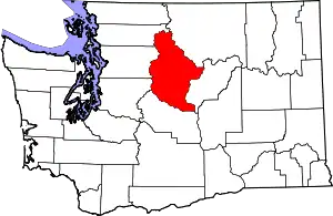 Map of Washington highlighting Chelan County | |
| CDPs | ||
| Other communities | ||
| Indian reservation | ||
| Ghost towns | ||
| Footnotes | ‡This populated place also has portions in an adjacent county or counties | |
| ||
This article is issued from Wikipedia. The text is licensed under Creative Commons - Attribution - Sharealike. Additional terms may apply for the media files.