Mazagran | |
|---|---|
Village | |
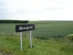 Signboard at village's entrance | |
 Mazagran Locator map of Mazagran in France | |
| Coordinates: 49°23′35.76″N 4°35′5.8″E / 49.3932667°N 4.584944°E | |
| Country | France |
| Region | Grand Est |
| Department | Ardennes |
| Arrondissement | Vouziers |
| Canton | Machault[1] |
| Municipality | Tourcelles-Chaumont |
| Elevation | 100 m (300 ft) |
| Time zone | UTC+1 (CET) |
| • Summer (DST) | UTC+2 (CEST) |
| Postal code | 08400 |
| Area code | (+33) ... |
Mazagran (French pronunciation: [mazaɡʁɑ̃]) is a French village, part of the municipality (commune) of Tourcelles-Chaumont, in the department of Ardennes, Grand Est.
History
The locality was named after a battle holed up in 1840 in the Algerian town of Mazagran; between Algerian resistance forces and French troops, during the French conquest of Algeria.
Geography
Situated in an agricultural plateau few km from Tourcelles-Chaumont and Leffincourt; it has a central roundabout that is a junction point of several national roads to Reims, Vouziers, Châlons-en-Champagne, Rethel and Charleville-Mézières. The proper village is composed by few and scattered farms.
Literature
The French writer André Dhôtel set his 1947 novel "Le Plateau de Mazagran" in the village.
References
- ↑ (in French) The Canton of Machault on www.annuaire-mairie.fr
This article is issued from Wikipedia. The text is licensed under Creative Commons - Attribution - Sharealike. Additional terms may apply for the media files.