| Mazartag | |
|---|---|
| 麻扎塔格山 (Chinese) | |
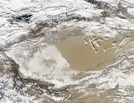 Mazartag (area not covered by snow in the snow-covered part of the desert) | |
| Highest point | |
| Elevation | 1,635 m (5,364 ft) |
| Dimensions | |
| Length | 145 km (90 mi) |
| Width | 3 km (1.9 mi) |
| Naming | |
| Native name | مازارتاغ (Uyghur) |
| Geography | |
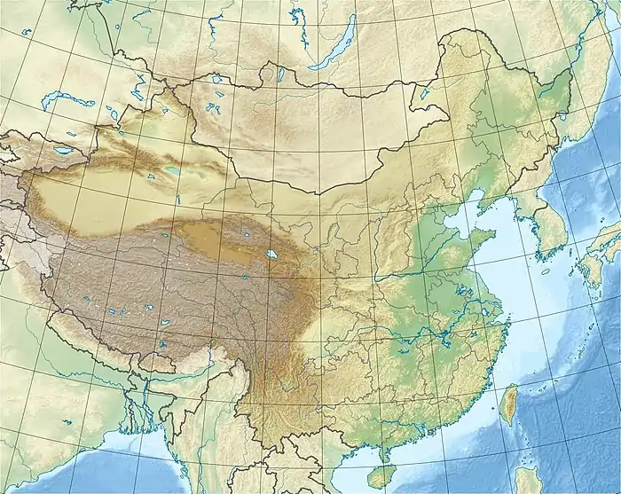 | |
| Country | China |
| Region | Xinjiang |
| District | Karakax County (Moyu), Hotan Prefecture |
| Range coordinates | 38°38′N 80°28′E / 38.64°N 80.47°E |
| Geology | |
| Type of rock | Composed mainly of sandstones |
Mazartag[1] (Uyghur: مازارتاغ,[2] Мазартағ, Mazartagh; Chinese: 麻扎塔格山; pinyin: Mázhātǎgé Shān, Ma-cha-t'a-ko) is an arc-shaped mountain range located in the western part of Tarim Basin, between the Hotan and Yarkand river valleys, Xinjiang, China. It is some 145 km long and 3 to 5 km wide; the highest peak rises to 1,635 m. The range is mainly composed of sandstone.[3]
Historical maps
Historical English-language maps including Mazartag:
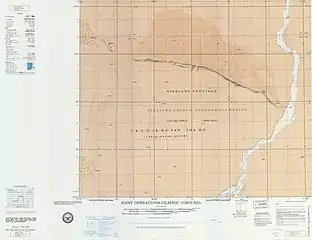 Map including Mazartag (ATC, 1971)
_p61_PLATE19._SINKIANG_(14597194848).jpg.webp) Map including Mazartag (labeled as Masartag) (1917)
Map including Mazartag (labeled as Masartag) (1917)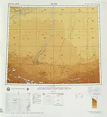 Map including Mazartag (USATC, 1971)[lower-alpha 1]
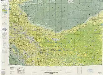 From the Operational Navigation Chart; map including Mazartag (DMA, 1980)[lower-alpha 2]
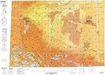 Map including Mazartag (DMA, 1984)[lower-alpha 3]
See also
Notes
References
- ↑ Mikhail Platonovich Petrov; Guy S. Alitto (18 December 2019). "Takla Makan Desert". Encyclopædia Britannica. Retrieved 25 January 2020.
The arc-shaped Mazartag Mountains, located between the Hotan and Yarkand (Ye'erqiang) river valleys, arch toward the southwest. Some 90 miles (145 km) long and 2 to 3 miles (3 to 5 km) wide, and with a maximum height of 5,363 feet (1,635 metres), they rise an average of only 1,000 to 1,150 feet (300 to 350 metres) above the surface of the sandy plain.
- ↑ مازار تاغ (Variant Non-Roman Script - VS) at GEOnet Names Server, United States National Geospatial-Intelligence Agency
- ↑ Мазартаг (in Russian). Great Soviet Encyclopedia. Retrieved 21 June 2020.
This article is issued from Wikipedia. The text is licensed under Creative Commons - Attribution - Sharealike. Additional terms may apply for the media files.