McLeod, Oregon | |
|---|---|
 McLeod  McLeod | |
| Coordinates: 42°39′43″N 122°41′17″W / 42.662°N 122.688°W | |
| Country | United States |
| State | Oregon |
| County | Jackson |
| Elevation | 1,552 ft (473 m) |
| Time zone | UTC-8 (Pacific (PST)) |
| • Summer (DST) | UTC-7 (PDT) |
| ZIP code | 97541 |
| Area code(s) | 458 and 541 |
| GNIS feature ID | 1146017[1] |
| Coordinates and elevation from Geographic Names Information System[1] | |
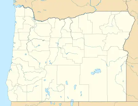
McLeod is an unincorporated community in Jackson County, Oregon, United States.[1] It lies at the confluence of Big Butte Creek with the Rogue River just downstream of Lost Creek Lake.[2] It is along Oregon Route 62 between Shady Cove and Prospect.[2] The community was named after its 1910 settler William R. McLeod.[3]
References
- 1 2 3 "McLeod". Geographic Names Information System. United States Geological Survey. November 28, 1980. Retrieved January 8, 2017.
- 1 2 Oregon Atlas & Gazetteer (7th ed.). Yarmouth, Maine: DeLorme. 2008. p. 61. ISBN 0-89933-347-8.
- ↑ McArthur, Lewis A.; McArthur, Lewis L (2003) [1928]. Oregon Geographic Names. Portland, Oregon: Oregon Historical Society Press. p. 629. ISBN 0-87595-277-1.
Municipalities and communities of Jackson County, Oregon, United States | ||
|---|---|---|
| Cities | 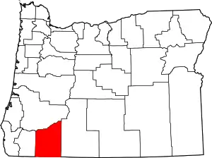 Jackson County map | |
| CDPs | ||
| Other unincorporated communities | ||
| Ghost towns | ||
This article is issued from Wikipedia. The text is licensed under Creative Commons - Attribution - Sharealike. Additional terms may apply for the media files.