| Meall nan Eun | |
|---|---|
 Meall nan Eun | |
| Highest point | |
| Elevation | 928 m (3,045 ft)[1] |
| Prominence | 174 m (571 ft) |
| Listing | Munro, Marilyn |
| Geography | |
| Location | Argyll and Bute, Scotland |
| Parent range | Grampian Mountains |
| OS grid | NN192449 |
| Topo map | OS Landranger 50 |
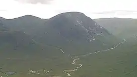
Meall nan Eun (928.1 m) is a mountain in the Grampian Mountains of Scotland. It is located east of Glen Etive in Argyll and Bute.
A dome like mountain with a rounded top but steep sides, it has a summit plateau. Climbs usually start from Glen Etive and the peak is often climbed together with the nearby Munro Stob Coir'an Albannaich.[2]
References
- ↑ "Meall nan Eun". hill-bagging.co.uk. Retrieved 4 June 2019.
- ↑ "walkhighlands Meall nan Eun". walkhighlands.co.uk. Retrieved 4 June 2019.
56°33′40″N 4°56′42″W / 56.561°N 4.945°W
This article is issued from Wikipedia. The text is licensed under Creative Commons - Attribution - Sharealike. Additional terms may apply for the media files.