Mieming | |
|---|---|
 | |
 Coat of arms | |
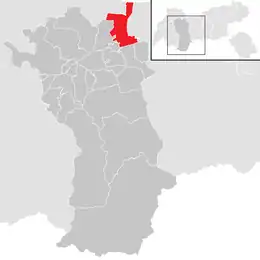 Location in the district | |
 Mieming Location within Austria | |
| Coordinates: 47°18′00″N 10°59′00″E / 47.30000°N 10.98333°E | |
| Country | Austria |
| State | Tyrol |
| District | Imst |
| Government | |
| • Mayor | Franz Dengg |
| Area | |
| • Total | 50.4 km2 (19.5 sq mi) |
| Elevation | 864 m (2,835 ft) |
| Population (2018-01-01)[2] | |
| • Total | 3,698 |
| • Density | 73/km2 (190/sq mi) |
| Time zone | UTC+1 (CET) |
| • Summer (DST) | UTC+2 (CEST) |
| Postal code | 6414 |
| Area code | 0 52 64 |
| Vehicle registration | IM |
| Website | www.mieming.tirol.gv.at |
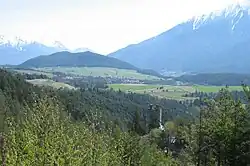
Mieming (German pronunciation: [ˈmiə̯mɪŋ] ⓘ) is a municipality in the Imst district and is located 19 km east of Imst and 6 km west of Telfs. Main sources of income are agriculture and Summer tourism.
Population
| Year | Pop. | ±% |
|---|---|---|
| 1869 | 1,078 | — |
| 1880 | 1,026 | −4.8% |
| 1890 | 913 | −11.0% |
| 1900 | 899 | −1.5% |
| 1910 | 888 | −1.2% |
| 1923 | 963 | +8.4% |
| 1934 | 1,090 | +13.2% |
| 1939 | 1,105 | +1.4% |
| 1951 | 1,219 | +10.3% |
| 1961 | 1,274 | +4.5% |
| 1971 | 1,450 | +13.8% |
| 1981 | 1,771 | +22.1% |
| 1991 | 2,202 | +24.3% |
| 2001 | 2,881 | +30.8% |
| 2011 | 3,445 | +19.6% |
References
- ↑ "Dauersiedlungsraum der Gemeinden Politischen Bezirke und Bundesländer - Gebietsstand 1.1.2018". Statistics Austria. Retrieved 10 March 2019.
- ↑ "Einwohnerzahl 1.1.2018 nach Gemeinden mit Status, Gebietsstand 1.1.2018". Statistics Austria. Retrieved 9 March 2019.
External links
Wikimedia Commons has media related to Mieming.
This article is issued from Wikipedia. The text is licensed under Creative Commons - Attribution - Sharealike. Additional terms may apply for the media files.