| Mochrum loch | |
|---|---|
 | |
 Mochrum loch | |
| Location | Dumfries and Galloway, Scotland |
| Coordinates | 54°50′32″N 4°38′57″W / 54.842300°N 4.649300°W |
| Type | freshwater loch |
| Primary inflows | Castle Loch, Dumfries and Galloway burn |
| Primary outflows | Water of Malzie |
| Basin countries | Scotland |
| Max. length | 1.5 mi (2.4 km)[1] |
| Max. width | 0.33 mi (0.53 km)[1] |
| Surface area | 92 ha (230 acres)[2] |
| Average depth | 7 ft (2.1 m)[1] |
| Max. depth | 13 ft (4.0 m)[1] |
| Water volume | 68,000,000 cu ft (1,900,000 m3)[1] |
| Shore length1 | 10.2 km (6.3 mi)[2] |
| Surface elevation | 75 m (246 ft)[2] |
| Islands | 8 islets[2] |
| 1 Shore length is not a well-defined measure. | |
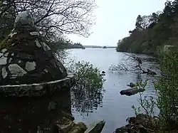
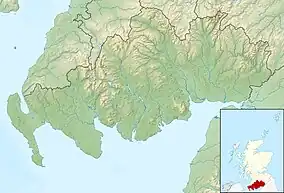
Mochrum Loch is a large, irregular shaped, shallow, freshwater loch in Dumfries and Galloway, in the Southern Uplands of south-west Scotland. It lies approximately 8 mi (13 km) west of the town of Wigtown.[1] The loch has several rocky islets.
Survey
The loch was surveyed[1] in 1903 by James Murray and later charted [3] as part of Sir John Murray's Bathymetrical Survey of Fresh-Water Lochs of Scotland 1897-1909.
References
- 1 2 3 4 5 6 7 "Bathymetrical Survey of the Fresh-Water Lochs of Scotland, 1897-1909, Lochs of the Cree Basin". National Library of Scotland. National Library of Scotland. Retrieved 16 September 2015.
- 1 2 3 4 "Mochrum loch". British lakes. British Lakes. Retrieved 16 September 2015.
- ↑ "Lochs Castle & Mochrum (Vol. 5, Plate 41) - Bathymetrical Survey, 1897-1909 - National Library of Scotland". National Library of Scotland. Retrieved 16 September 2015.
This article is issued from Wikipedia. The text is licensed under Creative Commons - Attribution - Sharealike. Additional terms may apply for the media files.