| Mount Collinson | |
|---|---|
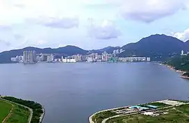 The view of Mount Collinson (right) from Junk Bay in 2006 | |
| Highest point | |
| Elevation | 348 m (1,142 ft) |
| Prominence | 180 m (590 ft) |
| Isolation | 2.1 km (1.3 mi) |
| Coordinates | 22°15′06″N 114°14′07″E / 22.251742°N 114.235277°E |
| Geography | |
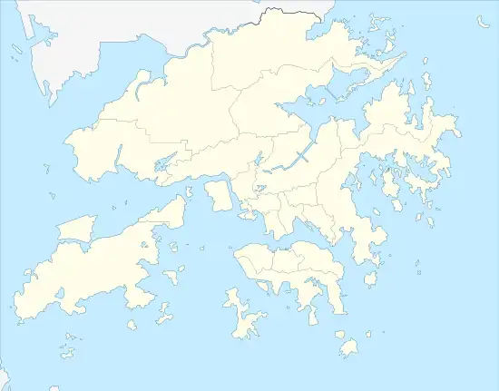 Mount Collinson Location of Hong Kong | |
| Location | Far East of Hong Kong Island,Hong Kong SAR |
Mount Collinson (Chinese: 歌連臣山) is a mountain located in the far east of Hong Kong Island, Hong Kong. The mountain has a sea level elevation of 348 m (1,142 ft).[1][2]
It is situated within the Shek O Country Park, which has an area of 7.01 square kilometres (2.71 square miles). It is located in the southeastern corner of Hong Kong Island. There are 7 named peaks in the park, and Mount Collinson is the highest among them.[3]
| Mount Collinson | |||||||||||||||||
|---|---|---|---|---|---|---|---|---|---|---|---|---|---|---|---|---|---|
| Traditional Chinese | 歌連臣山 | ||||||||||||||||
| Simplified Chinese | 歌连臣山 | ||||||||||||||||
| Literal meaning | Collinson Mountain | ||||||||||||||||
| |||||||||||||||||
Location
Hong Kong Trail Section 8 crosses the slope side of the mountain, which connects between Shek O Peak (also known as Dragon Back)'s intersection point, Tai Tam Gap Correctional Institution and Tai Long Wan (Sai Kung District).[4]
Summit
Despite having no properly-paved trails to reach the summit, it is still marked with a summit marking pillar. The Tai Tam Gap is facing northbound from the summit, with Shek O facing southbound.
References
- ↑ "Mount Collinson". PeakVisor. Retrieved 2023-05-15.
- ↑ "Mount Collinson - Peakbagger.com". www.peakbagger.com. Retrieved 2023-05-16.
- ↑ "Shek O Country Park". PeakVisor. Retrieved 2023-05-24.
- ↑ "Shek O Country Park". www.afcd.gov.hk. Retrieved 2023-05-25.