Mount Emmons, Utah | |
|---|---|
 Mount Emmons  Mount Emmons | |
| Coordinates: 40°20′52″N 110°16′31″W / 40.34778°N 110.27528°W | |
| Country | United States |
| State | Utah |
| County | Duchesne |
| Elevation | 6,293 ft (1,918 m) |
| Time zone | UTC-7 (Mountain (MST)) |
| • Summer (DST) | UTC-6 (MDT) |
| Area code | 435 |
| GNIS feature ID | 1430521[1] |
Mount Emmons is an unincorporated community in Duchesne County, Utah, United States.[1] The community is on Utah State Route 87 1 mile (1.6 km) southeast of Altamont.[2]
References
- 1 2 "Mount Emmons". Geographic Names Information System. United States Geological Survey, United States Department of the Interior.
- ↑ Utah Official Highway Map (Map). Utah Department of Transportation. 2017. Retrieved November 16, 2020.
Municipalities and communities of Duchesne County, Utah, United States | ||
|---|---|---|
| Cities | 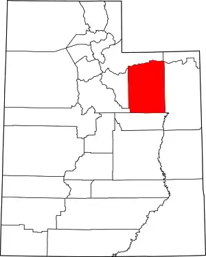 Map of Utah highlighting Duchesne County | |
| Towns | ||
| CDPs | ||
| Unincorporated communities | ||
| Indian reservation | ||
| Ghost towns | ||
| Footnotes | ‡This populated place also has portions in an adjacent county or counties | |
This article is issued from Wikipedia. The text is licensed under Creative Commons - Attribution - Sharealike. Additional terms may apply for the media files.