| Mount Heber | |
|---|---|
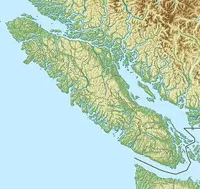 Mount Heber  Mount Heber Mount Heber (British Columbia) | |
| Highest point | |
| Elevation | 1,683 m (5,522 ft) |
| Prominence | 533 m (1,749 ft) |
| Coordinates | 49°53′48.8″N 125°55′00.8″W / 49.896889°N 125.916889°W |
| Geography | |
| Location | Vancouver Island, British Columbia, Canada |
| District | Nootka Land District |
| Parent range | Vancouver Island Ranges |
| Topo map | NTS 92F13 Upper Campbell Lake |
Mount Heber is a mountain on Vancouver Island, British Columbia, Canada, located 16 km (10 mi) northeast of Gold River and 8 km (5 mi) west of Big Den Mountain.[1]
See also
References
- ↑ Mount Heber in the Canadian Mountain Encyclopedia
External links
This article is issued from Wikipedia. The text is licensed under Creative Commons - Attribution - Sharealike. Additional terms may apply for the media files.