| Mount Japfü | |
|---|---|
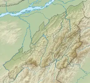 Mount Japfü Location in Nagaland, India  Mount Japfü Mount Japfü (India)  Mount Japfü Mount Japfü (Asia) .svg.png.webp) Mount Japfü Mount Japfü (Earth) | |
| Highest point | |
| Elevation | 3,048 m (10,000 ft) |
| Listing | |
| Coordinates | 25°35′51″N 94°04′00″E / 25.59750°N 94.06667°E |
| Geography | |
| Location | Kohima District, Nagaland |
| Parent range | Barail Range |
| Climbing | |
| Easiest route | Hiking |
Mount Japfü (/jæpfu/, YAP-FU), is a mountain peak of the Barail Range, located in Kohima District of Nagaland in India, about 15 kilometres (9 mi) south of Kohima, the capital of Nagaland. With a summit elevation of 3,048 m (10,000 ft), it is the fourth highest mountain in the Indian state of Nagaland and the highest in the Barail Range.[1][2]
Mount Japfü holds the Guinness World Record for the tallest Rhododendron tree in the world. It was discovered in 1993 and recorded a height of 20 m (65 ft).[3]
The peak of Mount Japfü receives snowfall in the winter months from December to February.[4]
See also
References
- ↑ "Of a fire in Mount Japfü". Eastern Mirror. 17 October 2021. Retrieved 2 March 2022.
- ↑ "When in Nagaland, check out these 5 trekking destinations". East Mojo. 14 January 2020. Retrieved 9 June 2023.
- ↑ "Largest rhododendron". Guinness World Records. Retrieved 20 March 2023.
- ↑ Phukan, Joydeep (29 May 2021). "Mount Japfu Peak Trek in Nagaland - A travelogue & trek guide". The Gypsy Chiring. Retrieved 25 May 2023.
This article is issued from Wikipedia. The text is licensed under Creative Commons - Attribution - Sharealike. Additional terms may apply for the media files.