| Mountain Creek Tributary to Georges Creek | |
|---|---|
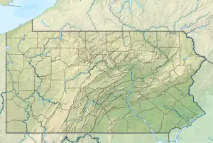 Location of Mountain Creek mouth  Mountain Creek (Georges Creek tributary) (the United States) | |
| Location | |
| Country | United States |
| State | Pennsylvania |
| County | Fayette |
| Physical characteristics | |
| Source | Laurel Run divide |
| • location | about 4 miles east of Haydentown, Pennsylvania[1] |
| • coordinates | 39°47′46″N 079°43′04″W / 39.79611°N 79.71778°W[2] |
| • elevation | 2,460 ft (750 m)[1] |
| Mouth | Georges Creek |
• location | about 1.5 miles south of Smithfield, Pennsylvania[3] |
• coordinates | 39°47′01″N 079°48′42″W / 39.78361°N 79.81167°W[2] |
• elevation | 940 ft (290 m)[3] |
| Length | 6.21 mi (9.99 km)[4] |
| Basin size | 16.70 square miles (43.3 km2)[5] |
| Discharge | |
| • location | Georges Creek |
| • average | 30.64 cu ft/s (0.868 m3/s) at mouth with Georges Creek[5] |
| Basin features | |
| Progression | generally west[4] |
| River system | Monongahela River |
| Tributaries | |
| • left | unnamed tributaries |
| • right | unnamed tributaries |
| Bridges | Hardin Hollow Road, Barton Hollow Road, PA 857, Haydentown Hill Road, PA 43, Chess Road, Rubles Mill Road, Gans Woodbridge Road, Ringer Road |
Mountain Creek is a 6.21 mi (9.99 km) long 3rd order tributary to Georges Creek in Fayette County, Pennsylvania.
Course
Mountain Creek rises about 4 miles east of Haydentown, Pennsylvania,[1] and then flows westerly to join Georges Creek about 1.5 miles south of Smithfield.[3]
Watershed
Mountain Creek drains 16.70 square miles (43.3 km2) of area, receives about 47.9 in/year of precipitation, has a wetness index of 354.36, and is about 76% forested.[5]
See also
References
- 1 2 3 "Get Maps". USGS Topoview. US Geological Survey. Retrieved 30 November 2020.
- 1 2 "GNIS Detail - Mountain Creek". geonames.usgs.gov. US Geological Survey. Retrieved 30 November 2020.
- 1 2 3 "Get Maps". USGS Topoview. US Geological Survey. Retrieved 30 November 2020.
- 1 2 "ArcGIS Web Application". epa.maps.arcgis.com. US EPA. Retrieved 30 November 2020.
- 1 2 3 "Mountain Creek Watershed Report". US EPA Geoviewer. US EPA. Retrieved 30 November 2020.
This article is issued from Wikipedia. The text is licensed under Creative Commons - Attribution - Sharealike. Additional terms may apply for the media files.