Mường Lay
Thị xã Mường Lay | |
|---|---|
| Mường Lay Town | |
 | |
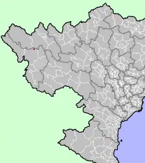 Location in northern Vietnam | |
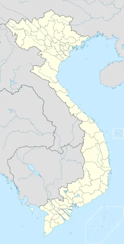 Mường Lay Location in Vietnam | |
| Coordinates: 22°4′4″N 103°9′2″E / 22.06778°N 103.15056°E | |
| Country | |
| Region | Northwest |
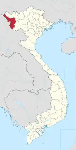
| Province | Điện Biên |
| Established | 8 October 1971 |
| Area | |
| • Town (Class-4) | 114.035 km2 (44.029 sq mi) |
| • Urban | 52.41 km2 (20.24 sq mi) |
| Population (2018) | |
| • Town (Class-4) | 20,450 |
| • Density | 180/km2 (500/sq mi) |
| • Urban | 13,190 |
| • Urban density | 250/km2 (650/sq mi) |
| Time zone | UTC+7 (UTC + 7) |
| Climate | Cwa |

Mường Lay
Mường Lay is a town of Điện Biên Province in the Northwest region of Vietnam.
Geography
Administrative divisions
Muong Cha has 3 administrative units, including two wards (phường) and one commune (xã):
Climate
| Climate data for Mường Lay | |||||||||||||
|---|---|---|---|---|---|---|---|---|---|---|---|---|---|
| Month | Jan | Feb | Mar | Apr | May | Jun | Jul | Aug | Sep | Oct | Nov | Dec | Year |
| Record high °C (°F) | 34.3 (93.7) |
38.0 (100.4) |
39.0 (102.2) |
41.0 (105.8) |
42.5 (108.5) |
39.1 (102.4) |
37.5 (99.5) |
38.9 (102.0) |
38.0 (100.4) |
37.0 (98.6) |
37.0 (98.6) |
34.0 (93.2) |
42.5 (108.5) |
| Mean daily maximum °C (°F) | 23.4 (74.1) |
25.9 (78.6) |
29.9 (85.8) |
32.4 (90.3) |
32.7 (90.9) |
31.7 (89.1) |
31.3 (88.3) |
32.0 (89.6) |
31.9 (89.4) |
29.9 (85.8) |
26.5 (79.7) |
23.5 (74.3) |
29.3 (84.7) |
| Daily mean °C (°F) | 17.0 (62.6) |
18.7 (65.7) |
21.9 (71.4) |
24.8 (76.6) |
26.4 (79.5) |
26.6 (79.9) |
26.5 (79.7) |
26.6 (79.9) |
25.9 (78.6) |
23.9 (75.0) |
20.4 (68.7) |
17.2 (63.0) |
23.0 (73.4) |
| Mean daily minimum °C (°F) | 13.6 (56.5) |
14.5 (58.1) |
16.7 (62.1) |
20.0 (68.0) |
22.5 (72.5) |
23.9 (75.0) |
23.8 (74.8) |
23.7 (74.7) |
22.6 (72.7) |
20.5 (68.9) |
17.1 (62.8) |
13.9 (57.0) |
19.4 (66.9) |
| Record low °C (°F) | 3.4 (38.1) |
7.1 (44.8) |
8.1 (46.6) |
12.9 (55.2) |
14.1 (57.4) |
18.2 (64.8) |
20.7 (69.3) |
19.1 (66.4) |
16.4 (61.5) |
10.0 (50.0) |
7.5 (45.5) |
3.6 (38.5) |
3.4 (38.1) |
| Average precipitation mm (inches) | 27 (1.1) |
36 (1.4) |
60 (2.4) |
135 (5.3) |
258 (10.2) |
438 (17.2) |
467 (18.4) |
372 (14.6) |
146 (5.7) |
91 (3.6) |
51 (2.0) |
25 (1.0) |
2,105 (82.9) |
| Average precipitation days | 5.4 | 5.1 | 7.4 | 13.2 | 19.5 | 23.8 | 25.8 | 22.0 | 13.0 | 10.1 | 6.8 | 5.7 | 157.9 |
| Average relative humidity (%) | 81.1 | 76.6 | 74.7 | 76.6 | 80.4 | 86.2 | 87.9 | 86.7 | 84.5 | 84.2 | 84.1 | 84.0 | 82.3 |
| Mean monthly sunshine hours | 131 | 144 | 186 | 200 | 186 | 120 | 123 | 150 | 164 | 153 | 138 | 131 | 1,824 |
| Source: Vietnam Institute for Building Science and Technology[1] | |||||||||||||
References
- ↑ "Vietnam Building Code Natural Physical & Climatic Data for Construction" (PDF) (in Vietnamese). Vietnam Institute for Building Science and Technology. Archived from the original (PDF) on 22 July 2018. Retrieved 5 August 2018.
| Điện Biên province |  | |
|---|---|---|
| Hòa Bình province | ||
| Lai Châu province | ||
| Lào Cai province | ||
| Sơn La province | ||
| Yên Bái province | ||
※ denotes provincial seat. | ||
Capital: Điện Biên Phủ | ||
| Điện Biên Phủ |
|  |
| Mường Lay | ||
| Điện Biên |
| |
| Điện Biên Đông | ||
| Mường Ảng |
| |
| Mường Chà |
| |
| Mường Nhé | ||
| Nậm Pồ | ||
| Tủa Chùa | ||
| Tuần Giáo |
| |
This article is issued from Wikipedia. The text is licensed under Creative Commons - Attribution - Sharealike. Additional terms may apply for the media files.