| Nattoralik | |
|---|---|
| Nagtoralik | |
Location of Nattoralik | |
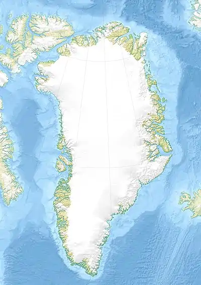 Nattoralik Location in Greenland | |
| Location | Arctic (SE Greenland) |
| Coordinates | 60°31′N 43°3′W / 60.517°N 43.050°W |
| Ocean/sea sources | North Atlantic Ocean |
| Basin countries | Greenland |
| Max. length | 8 km (5.0 mi) |
| Max. width | 1.8 km (1.1 mi) |
Nattoralik, old spelling Nagtoralik,[1] is a fjord in the King Frederick VI Coast, Kujalleq municipality, southern Greenland.
There is a Paleo-Eskimo archaeological site on the northern shore of the fjord.[2]
Geography
Nattoralik is a short fjord lying between the Kangerluaraq to the north and the Nanuuseq fjord to the south. It extends in a roughly east–west direction from its mouth in the North Atlantic Ocean for about 8 km until its head. Its entrance lies 3.5 mi (5.6 km) north of Nanuseq and Cape Walløe rises 4.5 mi (7.2 km) to the northeast.[3]
In the same manner as in the fjords further north, dark-hued mountains rise steeply from the coastline on both sides with heights averaging between 600 and 800 m.[4]
No glaciers reach the waters of this fjord, instead the fjord bends sharply northwards at its head ending in a valley with a succession of small lakes and a 932 m (3,058 ft) high snowy peak towering above it on its eastern side.[5]
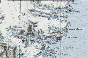 Map of Greenland section showing Nattoralik. |
See also
References
- ↑ Prostar Sailing Directions 2005 Greenland and Iceland Enroute, p. 100
- ↑ "Nattoralik archaeological/prehistoric site". Mapcarta. Retrieved 6 May 2016.
- ↑ Prostar Sailing Directions 2005 Greenland and Iceland Enroute, p. 100
- ↑ "Nattoralik Fjord". Mapcarta. Retrieved 6 May 2016.
- ↑ GoogleEarth
External links
- Den grønlandske Lods - Geodatastyrelsen
- Ketilidian structure and the rapakivi suite between Lindenow Fjord and Kap Farvel, South-East Greenland
- The Ketilidian orogen of South Greenland: geochronology, tectonics, magmatism, and fore-arc accretion during Palaeoproterozoic oblique convergence