| Nyuya Нюя / Ньүүйэ | |
|---|---|
 | |
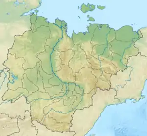 Mouth location in Yakutia, Russia | |
| Location | |
| Country | Russia |
| Physical characteristics | |
| Source | |
| • coordinates | 60°26′03″N 109°57′50″E / 60.43417°N 109.96389°E |
| Mouth | Lena |
• coordinates | 60°31′37″N 116°18′26″E / 60.527°N 116.3071°E |
| Length | 798 km (496 mi) |
| Basin size | 38,100 km2 (14,700 sq mi) |
| Discharge | |
| • average | 125 m3/s (4,400 cu ft/s) |
| Basin features | |
| Progression | Lena→ Laptev Sea |
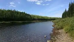
The Nyuya (Russian: Нюя; Yakut: Ньүүйэ, Ñüüye) is a river in Sakha, Russia. It is a left tributary of the Lena. The length of the river is 798 kilometres (496 mi). The area of its basin is 38,100 square kilometres (14,700 sq mi).[1]
Course
The Nyuya has its source in the Lena Plateau and flows south of the course of the Peleduy.[2] In its lower course it flows to the west of the Derba as it reaches the Lena floodplain and flows slowly, meandering in a swampy area. Finally it meets the Lena 2,420 kilometres (1,500 mi) from its mouth. There are over 600 lakes in the river basin.[3][4]
Tributaries
The main tributaries of the Nyuya are the 141 kilometres (88 mi) long Tympychan, the 181 kilometres (112 mi) long Khamaky, the 201 kilometres (125 mi) long Ulakhan-Murbayy, the 190 kilometres (120 mi) long Ochchuguy-Murbayy, and the 173 kilometres (107 mi) long Betinche. The Nyuya freezes up in the second half of October and stays icebound until May.[5][3][6]
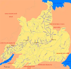 Basin of the Lena |
See also
References
- ↑ "Река Нюя in the State Water Register of Russia". textual.ru (in Russian).
- ↑ Нюя - Water of Russia
- 1 2 Google Earth
- ↑ "Топографска карта P-49, 50; M 1:1 000 000 - Topographic USSR Chart (in Russian)". Retrieved 3 April 2022.
- ↑ Nature.ykt
- ↑ Нюя, Great Soviet Encyclopedia
External links
 Media related to Nyuya River at Wikimedia Commons