| O Chum 2 Hydropower Dam | |
|---|---|
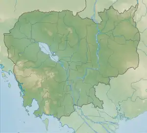 Location of O Chum 2 Hydropower Dam in Cambodia | |
| Official name | O Chum 2 Hydropower Dam |
| Country | Cambodia |
| Location | Banlung, Ratanakiri province, Cambodia |
| Coordinates | 13°46′20.4″N 106°59′14.3″E / 13.772333°N 106.987306°E |
| Opening date | 1992[1] |
| Owner(s) | Cambodia Government |
| Dam and spillways | |
| Type of dam | Seasonal Storage |
| Impounds | Lam Dom Noi River |
| Height | 10 m (33 ft) |
| Length | 107 m (351 ft) |
| Reservoir | |
| Creates | O Chum 2 Hydropower Dam Reservoir |
| Catchment area | 45 km2 (17 sq mi) |
| Power Station | |
| Installed capacity | 1 MW (1,300 hp) |
| Annual generation | 51 GWh (180 TJ) |
O Chum 2 Hydropower Dam is located on O Chum River, in Banlung, Ratanakiri Province, Cambodia. O Chum 2, commissioned in 1993, is a 1 MW mini-hydropower plant located in the north-east of Ratanakiri province. It is owned and operated by the Cambodian government and has an estimated annual generation output of between 2.2 and 2.5 GWh.[2]
The dam has the following characteristics:
- installed capacity 1 megawatt (1,300 hp)
- 51 gigawatt-hours (180 TJ) annually
- seasonal storage hydropower
- head 32.6 metres (107 ft)
- height 10 metres (33 ft)
- length 3,107 metres (10,194 ft)
- active storage 0.1 million cubic metres (3.5×10⁶ cu ft)
- catchment area 45 square kilometres (17 sq mi) .
See also
References
- ↑ http://cambodiahydropower.weebly.com/uploads/1/6/4/4/16448736/ci_cambodia_3s_river_factsheet_nov2013_low_res.pdf
- ↑ Cambodia’s Hydropower Development and China’s Involvement
External links
This article is issued from Wikipedia. The text is licensed under Creative Commons - Attribution - Sharealike. Additional terms may apply for the media files.