Ocala Estates, Florida | |
|---|---|
 Ocala Estates  Ocala Estates | |
| Coordinates: 29°12′9″N 82°18′33″W / 29.20250°N 82.30917°W | |
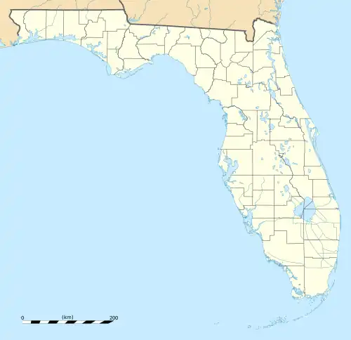
| Country | |
| State | Florida |
| County | Marion |
| Area | |
| • Total | 0.97 sq mi (2.53 km2) |
| • Land | 0.97 sq mi (2.53 km2) |
| • Water | 0.00 sq mi (0.00 km2) |
| Elevation | 70 ft (20 m) |
| Population | |
| • Total | 2,991 |
| • Density | 3,067.69/sq mi (1,183.86/km2) |
| Time zone | UTC-5 (Eastern (EST)) |
| • Summer (DST) | UTC-4 (EDT) |
| ZIP Code | 34482 (Ocala) |
| Area code | 352 |
| FIPS code | 12-50756 |
| GNIS feature ID | 2805182[2] |
Ocala Estates is an unincorporated community and census-designated place (CDP) in western Marion County, Florida, United States. It is 11 miles (18 km) west of Ocala, the county seat.
Ocala Estates was first listed as a CDP for the 2020 census, at which time it had a population of 2,991.[3]
Demographics
| Census | Pop. | Note | %± |
|---|---|---|---|
| 2020 | 2,991 | — | |
| U.S. Decennial Census[4] | |||
References
- ↑ "2022 U.S. Gazetteer Files: Florida". United States Census Bureau. Retrieved December 19, 2022.
- 1 2 "Ocala Estates Census Designated Place". Geographic Names Information System. United States Geological Survey, United States Department of the Interior.
- 1 2 "P1. Race – Ocala Estates CDP, Florida: 2020 DEC Redistricting Data (PL 94-171)". U.S. Census Bureau. Retrieved December 19, 2022.
- ↑ "Census of Population and Housing". Census.gov. Retrieved June 4, 2016.
Municipalities and communities of Marion County, Florida, United States | ||
|---|---|---|
| Cities | 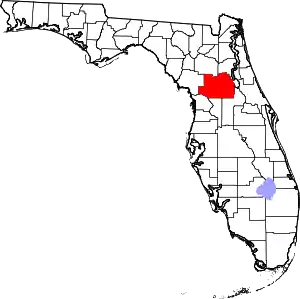 | |
| Towns | ||
| CDPs | ||
| Unincorporated communities | ||
| Footnotes | ‡This populated place also has portions in an adjacent county or counties | |
This article is issued from Wikipedia. The text is licensed under Creative Commons - Attribution - Sharealike. Additional terms may apply for the media files.