Ochlocknee, Georgia | |
|---|---|
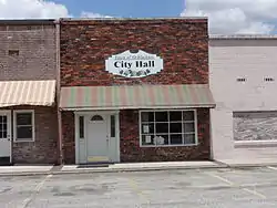 Ochlocknee City Hall | |
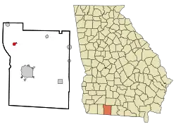 Location in Thomas County and the state of Georgia | |
| Coordinates: 30°58′31″N 84°3′20″W / 30.97528°N 84.05556°W | |
| Country | United States |
| State | Georgia |
| County | Thomas |
| Area | |
| • Total | 0.96 sq mi (2.47 km2) |
| • Land | 0.93 sq mi (2.40 km2) |
| • Water | 0.03 sq mi (0.07 km2) |
| Elevation | 269 ft (82 m) |
| Population (2020) | |
| • Total | 672 |
| • Density | 725.70/sq mi (280.11/km2) |
| Time zone | UTC-5 (Eastern (EST)) |
| • Summer (DST) | UTC-4 (EDT) |
| ZIP code | 31773 |
| Area code | 229 |
| FIPS code | 13-57372[2] |
| GNIS feature ID | 0356440[3] |
Ochlocknee is a town in Thomas County, Georgia, United States. The population was 672 in 2020. The city was incorporated on January 1, 1970.
Geography
Ochlocknee is located at 30°58′31″N 84°3′20″W / 30.97528°N 84.05556°W (30.975409, -84.055425).[4] According to the United States Census Bureau, the town has a total area of 0.9 square miles (2.3 km2), of which 0.9 square miles (2.3 km2) is land and 1.05% is water.
Demographics
| Census | Pop. | Note | %± |
|---|---|---|---|
| 1880 | 117 | — | |
| 1890 | 202 | 72.6% | |
| 1900 | 244 | 20.8% | |
| 1910 | 350 | 43.4% | |
| 1920 | 410 | 17.1% | |
| 1930 | 443 | 8.0% | |
| 1940 | 429 | −3.2% | |
| 1950 | 503 | 17.2% | |
| 1960 | 502 | −0.2% | |
| 1970 | 611 | 21.7% | |
| 1980 | 627 | 2.6% | |
| 1990 | 588 | −6.2% | |
| 2000 | 605 | 2.9% | |
| 2010 | 676 | 11.7% | |
| 2020 | 672 | −0.6% | |
| U.S. Decennial Census[5] | |||
As of the census[2] of 2000, there were 605 people, 230 households, and 164 families residing in the town. By 2020, its population increased to 6572.
Arts and culture
The city has celebrated Old South Day, a food and arts and crafts festival, every year since 1976.[6]
References
- ↑ "2020 U.S. Gazetteer Files". United States Census Bureau. Retrieved December 18, 2021.
- 1 2 "U.S. Census website". United States Census Bureau. Retrieved January 31, 2008.
- ↑ "US Board on Geographic Names". United States Geological Survey. October 25, 2007. Retrieved January 31, 2008.
- ↑ "US Gazetteer files: 2010, 2000, and 1990". United States Census Bureau. February 12, 2011. Retrieved April 23, 2011.
- ↑ "Census of Population and Housing". Census.gov. Retrieved June 4, 2015.
- ↑ Turner, Alicia (November 12, 2015). "Annual 'Old South Day' in Ochlocknee". WCTV. Retrieved June 2, 2018.
Municipalities and communities of Thomas County, Georgia, United States | ||
|---|---|---|
| Cities | 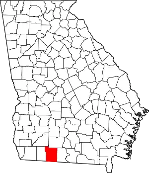 Map of Georgia highlighting Thomas County | |
| Town | ||
| Unincorporated communities | ||
| Footnotes | ‡This populated place also has portions in an adjacent county or counties | |
This article is issued from Wikipedia. The text is licensed under Creative Commons - Attribution - Sharealike. Additional terms may apply for the media files.