Oldfield | |
|---|---|
dispersed rural community | |
 Oldfield 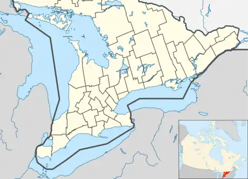 Oldfield | |
| Coordinates: 42°32′37″N 82°18′49″W / 42.54361°N 82.31361°W[1] | |
| Country | Canada |
| Province | Ontario |
| Region | Southwestern Ontario |
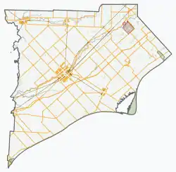
| Municipality | Chatham-Kent |
| Elevation | 177 m (581 ft) |
| Time zone | UTC-5 (Eastern Time Zone) |
| • Summer (DST) | UTC-4 (Eastern Time Zone) |
| Postal code | N0P 2M0 |
| Area codes | 519, 226, 548 |
Oldfield is a dispersed rural community in the municipality of Chatham-Kent in Southwestern Ontario, Canada.[1][3][4][5][6] It is 8 kilometres (5.0 mi) southeast of Wallaceburg, and is on Chatham-Kent Road 42 (signed there as the Oldfield Line), 2.7 kilometres (1.7 mi) east of Ontario Highway 40. Maxwell Creek flows along the north side of the community.[3][4]
References
- 1 2 "Oldfield". Geographical Names Data Base. Natural Resources Canada. Retrieved 2020-08-05.
- ↑ "Google Earth". Retrieved 2020-08-05.
- 1 2 "Toporama (on-line map and search)". Atlas of Canada. Natural Resources Canada. 12 September 2016. Retrieved 2020-08-05.
- 1 2 "Ontario Geonames GIS (on-line map and search)". Ontario Ministry of Natural Resources and Forestry. 2014. Retrieved 2020-08-05.
- ↑ Restructured municipalities - Ontario map #6 (Map). Restructuring Maps of Ontario. Ontario Ministry of Municipal Affairs and Housing. 2006. Retrieved 2020-08-05.
- ↑ Map 1 (PDF) (Map). 1 : 700,000. Official road map of Ontario. Ministry of Transportation of Ontario. 2018-01-01. Retrieved 2020-08-05.
This article is issued from Wikipedia. The text is licensed under Creative Commons - Attribution - Sharealike. Additional terms may apply for the media files.