| Owens Branch Tributary to Ararat River | |
|---|---|
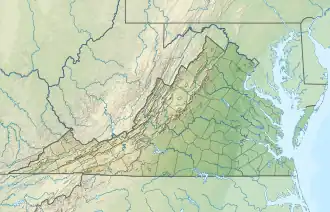 Location of Owens Branch mouth  Owens Branch (Ararat River tributary) (the United States) | |
| Location | |
| Country | United States |
| State | Virginia |
| County | Patrick |
| Physical characteristics | |
| Source | Doe Run Creek divide |
| • location | about 4 miles northwest of The Hollow, Virginia |
| • coordinates | 36°37′24″N 080°34′24″W / 36.62333°N 80.57333°W[1] |
| • elevation | 1,880 ft (570 m)[2] |
| Mouth | Ararat River |
• location | about 1 mile west of The Hollow, Virginia |
• coordinates | 36°35′00″N 080°33′25″W / 36.58333°N 80.55694°W[1] |
• elevation | 1,178 ft (359 m)[2] |
| Length | 4.06 mi (6.53 km)[3] |
| Basin size | 3.20 square miles (8.3 km2)[4] |
| Discharge | |
| • location | Ararat River |
| • average | 5.33 cu ft/s (0.151 m3/s) at mouth with Ararat River[4] |
| Basin features | |
| Progression | Ararat River → Yadkin River → Pee Dee River → Winyah Bay → Atlantic Ocean |
| River system | Yadkin River |
| Tributaries | |
| • left | unnamed tributaries |
| • right | unnamed tributaries |
| Bridges | Green Spring Road, Friends Mission Road, Farmers Road, The Hollow Road |
Owens Branch is a 4.06 mi (6.53 km) long 2nd order tributary to the Ararat River in Patrick County, Virginia.
Course
Owens Branch rises on the Doe Run Creek divide about 4 miles northwest of The Hollow in Patrick County. Owens Branch then follows a southerly course to join the Ararat River about 1 mile west of The Hollow, Virginia.[2]
Watershed
Owens Branch drains 3.20 square miles (8.3 km2) of area, receives about 49.3 in/year of precipitation, has a wetness index of 312.67, and is about 62% forested.[4]
See also
References
- 1 2 "GNIS Detail - Owens Branch". geonames.usgs.gov. US Geological Survey. Retrieved 19 September 2020.
- 1 2 3 "Clarks Creek Topo Map in Patrick". TopoZone. Locality, LLC. Retrieved 19 September 2020.
- ↑ "ArcGIS Web Application". epa.maps.arcgis.com. US EPA. Retrieved 19 September 2020.
- 1 2 3 "Owens Branch Watershed Report". US EPA Geoviewer. US EPA. Retrieved 19 September 2020.
This article is issued from Wikipedia. The text is licensed under Creative Commons - Attribution - Sharealike. Additional terms may apply for the media files.