Pacheri | |
|---|---|
village | |
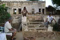 Pacheri Fort | |
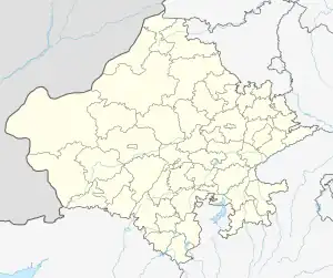 Pacheri Location in Rajasthan, India  Pacheri Pacheri (India) | |
| Coordinates: 28°09′00″N 75°56′00″E / 28.1500°N 75.9333°E | |
| Country | |
| State | Rajasthan |
| District | Jhunjhunu |
| Elevation | 958 m (3,143 ft) |
| Population (2011) | |
| • Total | 3,974 |
| Languages | |
| • Official | Hindi |
| Time zone | UTC+5:30 (IST) |
| ISO 3166 code | IN-RJ |
Pacheri is a village in the state of Rajasthan, India. It has a population of over 3974 residents.[1]
Geography
Pacheri is located at 28°09′N 75°56′E / 28.15°N 75.93°E.[2] It has an average elevation of 291 metres (958 feet).
References
- ↑ "Pacheri Kalan Population 2022/2023, Village in Buhana Tehsil". www.indiagrowing.com. Retrieved 21 January 2023.
- ↑ "Maps, Weather, and Airports for Pacheri, India". www.fallingrain.com. Retrieved 26 March 2018.
This article is issued from Wikipedia. The text is licensed under Creative Commons - Attribution - Sharealike. Additional terms may apply for the media files.