Palladuc | |
|---|---|
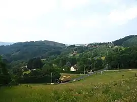 A general view of Palladuc | |
Location of Palladuc | |
 Palladuc  Palladuc | |
| Coordinates: 45°54′18″N 3°37′44″E / 45.905°N 3.629°E | |
| Country | France |
| Region | Auvergne-Rhône-Alpes |
| Department | Puy-de-Dôme |
| Arrondissement | Thiers |
| Canton | Thiers |
| Intercommunality | Thiers Dore et Montagne |
| Government | |
| • Mayor (2020–2026) | Caroline Guélon-Bévillard[1] |
| Area 1 | 13.35 km2 (5.15 sq mi) |
| Population | 522 |
| • Density | 39/km2 (100/sq mi) |
| Time zone | UTC+01:00 (CET) |
| • Summer (DST) | UTC+02:00 (CEST) |
| INSEE/Postal code | 63267 /63550 |
| Elevation | 587–1,287 m (1,926–4,222 ft) (avg. 749 m or 2,457 ft) |
| 1 French Land Register data, which excludes lakes, ponds, glaciers > 1 km2 (0.386 sq mi or 247 acres) and river estuaries. | |
Palladuc (French pronunciation: [paladyk]) is a commune in the Puy-de-Dôme department in Auvergne-Rhône-Alpes in central France.[3]
See also
References
- ↑ "Répertoire national des élus: les maires" (in French). data.gouv.fr, Plateforme ouverte des données publiques françaises. 13 September 2022.
- ↑ "Populations légales 2021". The National Institute of Statistics and Economic Studies. 28 December 2023.
- ↑ "INSEE commune file".
Wikimedia Commons has media related to Palladuc.
This article is issued from Wikipedia. The text is licensed under Creative Commons - Attribution - Sharealike. Additional terms may apply for the media files.