Pangsha
পাংশা | |
|---|---|
.svg.png.webp) | |
| Coordinates: 23°47.5′N 89°25′E / 23.7917°N 89.417°E | |
| Country | |
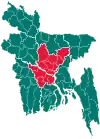
| Division | Dhaka |
| District | Rajbari |
| Area | |
| • Total | 250.31 km2 (96.65 sq mi) |
| Population (2011) | |
| • Total | 207,086 |
| • Density | 830/km2 (2,100/sq mi) |
| Time zone | UTC+6 (BST) |
| Website | pangsa |
Pangsha (Bengali: পাংশা) is an upazila of Rajbari District[1] in the Division of Dhaka, Bangladesh.
Geography
Pangsha is located at 23°47′30″N 89°25′00″E / 23.7917°N 89.4167°E. It has 56,336 households and a total area of 250.31 km2.
Demographics
As of the 2011 Bangladesh census, Pangsha upazila had 56,336 households and a population of 207,086. 55,759 (26.93%) were under 10 years of age. Pangsha had an average literacy rate of 48.3%, compared to the national average of 51.8%, and a sex ratio of 999 females per 1000 males. 32,949 (13.54%) of the population lived in urban areas.[2][3]
According to the 1991 Bangladesh census, Pangsha had a population of 316,752, of whom 151,566 were aged 18 or older. Males constituted 51.78% of the population, and females 48.22%. Pangsha had an average literacy rate of 23.1% (7+ years), against the national average of 32.4%.[4] mashhpara 23.75/89.36. Bagduli High School. Pangsha Rajbari Maurat latitude 23.47 longitude89,25
Administration
Pangsha Upazila is divided into Pangsha Municipality and ten union parishads: Babupara, Bahadurpur, Habashpur, Jashai, Kalimahar, Kasbamajhail, Machhpara, Mourat, Patta, and Sarisha. The union parishads are subdivided into 162 mauzas and 192 villages.[2]
Pangsha Municipality is subdivided into 9 wards and 21 mahallas.[2]
Notable people
- Kaushik Ali Chowdhury, Bengali essayist
- Rowshan Ali Chowdhury, journalist
Gallery
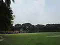 Pangsha Govt. College Campus.
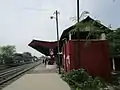 Pangsha Railway Station.
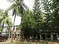 Pangsha Upazila Complex building.
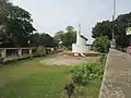 The 1971 war monument at Pangsha Upazila
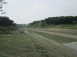 Chandana River at Pangsha.
See also
References
- ↑ Md. Tawhid Mia (2012), "Pangsha Upazila", in Sirajul Islam and Ahmed A. Jamal (ed.), Banglapedia: National Encyclopedia of Bangladesh (Second ed.), Asiatic Society of Bangladesh
- 1 2 3 4 "Bangladesh Population and Housing Census 2011 Zila Report – Rajbari" (PDF). bbs.gov.bd. Bangladesh Bureau of Statistics.
- ↑ "Community Tables: Rajbari district" (PDF). bbs.gov.bd. Bangladesh Bureau of Statistics. 2011. p. 103.
- ↑ "Population Census Wing, BBS". Archived from the original on 2005-03-27. Retrieved November 10, 2006.
| Upazila/Thana: | ||
|---|---|---|