Pinecroft, Pennsylvania | |
|---|---|
 Pinecroft  Pinecroft | |
| Coordinates: 40°33′57″N 78°21′3″W / 40.56583°N 78.35083°W | |
| Country | United States |
| State | Pennsylvania |
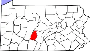
| County | Blair |
| Township | Antis |
| Area | |
| • Total | 0.24 sq mi (0.63 km2) |
| • Land | 0.24 sq mi (0.63 km2) |
| • Water | 0.00 sq mi (0.00 km2) |
| Elevation | 1,120 ft (340 m) |
| Population | |
| • Total | 300 |
| • Density | 1,239.67/sq mi (478.83/km2) |
| Time zone | UTC-5 (Eastern (EST)) |
| • Summer (DST) | UTC-4 (EDT) |
| ZIP Code | 16601 (Altoona) |
| Area code(s) | 814/582 |
| FIPS code | 42-60384 |
| GNIS feature ID | 2805542[3] |
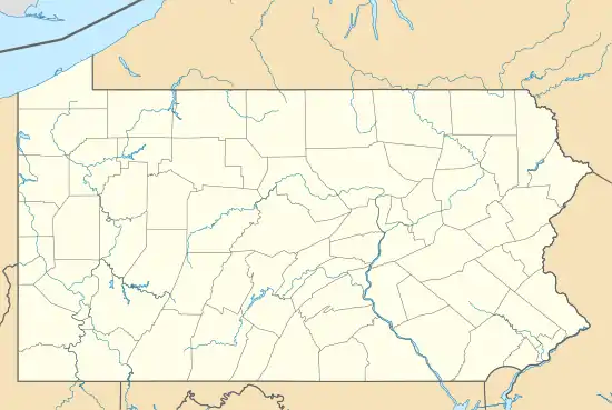
Pinecroft is an unincorporated community and census-designated place (CDP) in Blair County, Pennsylvania, United States. It was first listed as a CDP prior to the 2020 census.[3]
The CDP is in north-central Blair County, in the southern part of Antis Township. It is 4 miles (6 km) north of Altoona, the county's largest city. The Little Juniata River runs along the northwestern edge of the CDP.
Demographics
| Census | Pop. | Note | %± |
|---|---|---|---|
| 2020 | 300 | — | |
| U.S. Decennial Census[4] | |||
References
- ↑ "ArcGIS REST Services Directory". United States Census Bureau. Retrieved October 16, 2022.
- ↑ "Census Population API". United States Census Bureau. Retrieved October 16, 2022.
- 1 2 "Pinecroft Census Designated Place". Geographic Names Information System. United States Geological Survey, United States Department of the Interior.
- ↑ "Census of Population and Housing". Census.gov. Retrieved June 4, 2016.
This article is issued from Wikipedia. The text is licensed under Creative Commons - Attribution - Sharealike. Additional terms may apply for the media files.