Pockau-Lengefeld | |
|---|---|
 Coat of arms | |
Location of Pockau-Lengefeld within Erzgebirgskreis district 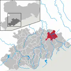 | |
 Pockau-Lengefeld 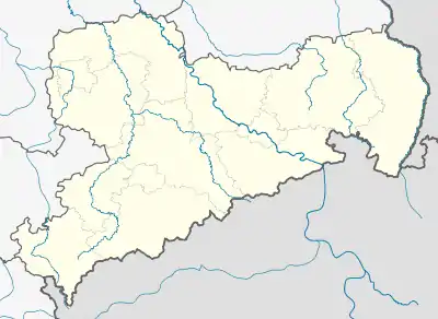 Pockau-Lengefeld | |
| Coordinates: 50°43′N 13°11′E / 50.717°N 13.183°E | |
| Country | Germany |
| State | Saxony |
| District | Erzgebirgskreis |
| Area | |
| • Total | 83.57 km2 (32.27 sq mi) |
| Elevation | 440 m (1,440 ft) |
| Population (2021-12-31)[1] | |
| • Total | 7,415 |
| • Density | 89/km2 (230/sq mi) |
| Time zone | UTC+01:00 (CET) |
| • Summer (DST) | UTC+02:00 (CEST) |
| Postal codes | 09509, 09514 |
| Dialling codes | 037367 |
| Vehicle registration | ERZ, ANA, ASZ, AU, MAB, MEK, STL, SZB, ZP |
| Website | pockau-lengefeld.de |
Pockau-Lengefeld is a town in the district Erzgebirgskreis, in Saxony, Germany. It is situated in the Ore Mountains, 23 km southeast of Chemnitz. It was formed by the merger of the municipality Pockau and the town Lengefeld on 1 January 2014.
References
This article is issued from Wikipedia. The text is licensed under Creative Commons - Attribution - Sharealike. Additional terms may apply for the media files.