Poligné
| |
|---|---|
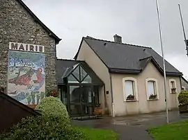 The town hall in Poligné | |
Location of Poligné | |
 Poligné  Poligné | |
| Coordinates: 47°53′17″N 1°41′06″W / 47.8881°N 1.685°W | |
| Country | France |
| Region | Brittany |
| Department | Ille-et-Vilaine |
| Arrondissement | Redon |
| Canton | Bain-de-Bretagne |
| Government | |
| • Mayor (2020–2026) | Guy Rinfray[1] |
| Area 1 | 9.24 km2 (3.57 sq mi) |
| Population | 1,228 |
| • Density | 130/km2 (340/sq mi) |
| Time zone | UTC+01:00 (CET) |
| • Summer (DST) | UTC+02:00 (CEST) |
| INSEE/Postal code | 35231 /35320 |
| Elevation | 12–93 m (39–305 ft) |
| 1 French Land Register data, which excludes lakes, ponds, glaciers > 1 km2 (0.386 sq mi or 247 acres) and river estuaries. | |
Poligné (French pronunciation: [pɔliɲe]; Gallo: Polinyae, Breton: Polinieg) is a commune in the Ille-et-Vilaine department of Brittany in northwestern France.
Geography
The river Semnon forms all of the commune's southwestern border.
Population
Inhabitants of Poligné are called polinéens in French.
| Year | Pop. | ±% |
|---|---|---|
| 1962 | 430 | — |
| 1968 | 456 | +6.0% |
| 1975 | 447 | −2.0% |
| 1982 | 492 | +10.1% |
| 1990 | 618 | +25.6% |
| 1999 | 760 | +23.0% |
| 2008 | 1,117 | +47.0% |
See also
References
- ↑ "Répertoire national des élus: les maires". data.gouv.fr, Plateforme ouverte des données publiques françaises (in French). 2 December 2020.
- ↑ "Populations légales 2021". The National Institute of Statistics and Economic Studies. 28 December 2023.
External links
Wikimedia Commons has media related to Poligné.
- Base Mérimée: Search for heritage in the commune, Ministère français de la Culture. (in French)
- Mayors of Ille-et-Vilaine Association (in French)
This article is issued from Wikipedia. The text is licensed under Creative Commons - Attribution - Sharealike. Additional terms may apply for the media files.