Pont Marie | |||||||||||
|---|---|---|---|---|---|---|---|---|---|---|---|
| Paris Métro station | |||||||||||
_-_2022-06-28_-_1.jpg.webp) Platforms view | |||||||||||
| General information | |||||||||||
| Location | 4th arrondissement of Paris Île-de-France France | ||||||||||
| Coordinates | 48°51′12″N 2°21′27″E / 48.85329°N 2.35762°E | ||||||||||
| Owned by | RATP | ||||||||||
| Operated by | RATP | ||||||||||
| Other information | |||||||||||
| Fare zone | 1 | ||||||||||
| History | |||||||||||
| Opened | 16 April 1926 | ||||||||||
| Services | |||||||||||
| |||||||||||
| Location | |||||||||||
 Pont Marie Location within Paris | |||||||||||
Pont Marie (French pronunciation: [pɔ̃ maʁi]) is a station of the Paris Métro opened in 1926 with the extension of Line 7 from Palais Royal–Musée du Louvre. It is named after the nearby bridge over the Seine, the Pont Marie, which connects to Île Saint-Louis.
Station layout
| Street Level |
| B1 | Connecting level |
| Line 7 platforms | Side platform, doors will open on the right | |
| Southbound | ← | |
| Northbound | | |
| Side platform, doors will open on the right | ||
Gallery
 Street-level entrance at Pont Marie
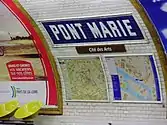 Platform signage at Pont Marie
Wikimedia Commons has media related to Pont Marie (Paris Metro).
References
- Roland, Gérard (2003). Stations de métro. D’Abbesses à Wagram. Éditions Bonneton.
This article is issued from Wikipedia. The text is licensed under Creative Commons - Attribution - Sharealike. Additional terms may apply for the media files.