Port of Brisbane Motorway | |
|---|---|
 | |
| General information | |
| Type | Motorway |
| Length | 6.9 km (4.3 mi) |
| Route number(s) |  M4 M4 |
| Major junctions | |
| SW end |  Gateway Motorway Gateway MotorwayMurarrie |
| |
| NE end |  Port Drive Port DriveLytton |
| Location(s) | |
| Major suburbs / towns | Hemmant |
| Highway system | |
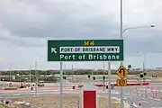
Port of Brisbane Motorway is a motorway which connects the Port of Brisbane to the Gateway Motorway. Stage 1 was opened in December 2002. The motorway was built to take freight traffic off Lytton Road, with about 4,000 vehicles travelling to the Port of Brisbane in 2002.[1] Stage 1 cost A$196 million and was finished six months ahead of schedule and A$20 million under budget.[2] The Port of Brisbane Motorway holds the M4 motorway designation.
Stage 2 includes a three kilometre extension of the existing motorway through to Pritchard Street. Construction commenced in April 2011 with completion in February 2013.[3] The project was named Port Connect, an A$385 million upgrade.[4]
A further stage of upgrade was completed on the connecting roads to the port. The project was named Port Drive Upgrade, an A$110 million upgrade from the eastern end of the Port of Brisbane Motorway through to Port Gate. Construction commenced in Q3 2016 and completed mid 2018.[5] It included duplication of Port Drive, an overpass at Kite Street intersection and duplication of Lucinda Drive.[6]
Interchanges
The entire motorway is in the City of Brisbane local government area.
| Location | km[7] | mi | Destinations | Notes | |
|---|---|---|---|---|---|
| Murarrie | 0 | 0.0 |  Gateway Motorway (M1) – Ipswich, Gold Coast, Sunshine Coast, Brisbane Airport Gateway Motorway (M1) – Ipswich, Gold Coast, Sunshine Coast, Brisbane Airport | South-western motorway terminus; semi-directional T interchange | |
| 0.9 | 0.56 | Lytton Road (State Route 24) – Murarrie, Brisbane | No exit westbound | ||
| Lytton | 3.8 | 2.4 |  Lytton Road (State Route 24) / Lindum Road (State Route 30) – Hemmant, Wynnum Lytton Road (State Route 24) / Lindum Road (State Route 30) – Hemmant, Wynnum | No north–eastbound entrance; south–westbound entrance via looped ramp | |
| 5.3 | 3.3 | Lytton Road (State Route 24) south / Pritchard Street (State Route 24) east – Lytton, Wynnum | North–eastbound exit and entrance only | ||
| 6.2 | 3.9 | Pritchard Street (State Route 24) – Lytton, Wynnum | South–westbound exit and entrance only | ||
| 6.9 | 4.3 | Port Drive north–east – Port of Brisbane | North–eastern motorway terminus: continues as Port Drive | ||
| 1.000 mi = 1.609 km; 1.000 km = 0.621 mi | |||||
Road diagram
The accompanying diagram shows the interchanges with and overpasses of the Port of Brisbane Motorway.
Port of Brisbane Motorway From North-East to South-West | |||||||||||||||||||||||||||||||||||||||||||||||||||||||||||||||||||||||||||||||||||||||||||||||||||||||||||||||||||||||||||||||||||||||||||||||||||
|---|---|---|---|---|---|---|---|---|---|---|---|---|---|---|---|---|---|---|---|---|---|---|---|---|---|---|---|---|---|---|---|---|---|---|---|---|---|---|---|---|---|---|---|---|---|---|---|---|---|---|---|---|---|---|---|---|---|---|---|---|---|---|---|---|---|---|---|---|---|---|---|---|---|---|---|---|---|---|---|---|---|---|---|---|---|---|---|---|---|---|---|---|---|---|---|---|---|---|---|---|---|---|---|---|---|---|---|---|---|---|---|---|---|---|---|---|---|---|---|---|---|---|---|---|---|---|---|---|---|---|---|---|---|---|---|---|---|---|---|---|---|---|---|---|---|---|---|
| |||||||||||||||||||||||||||||||||||||||||||||||||||||||||||||||||||||||||||||||||||||||||||||||||||||||||||||||||||||||||||||||||||||||||||||||||||


Gallery
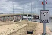 Port of Brisbane Motorway.
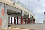 Pritchard St Overpass.
- Port of Brisbane Motorway sign.
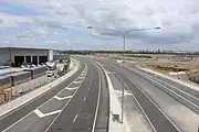 Port of Brisbane Motorway south view from overpass.
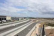 Port of Brisbane Motorway north view from overpass.
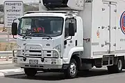 Port of Brisbane Motorway. A truck using the Motorway.
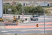 Road workers completing motorway
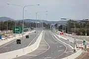 Port of Brisbane Motorway
See also
References
- ↑ Queensland Motorways - Port of Brisbane Motorway
- ↑ Media Release - 'New motorway to deliver trade benefits to Australia' 18 December 2002
- ↑ "Port of Brisbane Motorway open ahead of schedule" (pdf). Queensland Government. 21 February 2013. Retrieved 30 May 2013.
- ↑ "Project Overview" (PDF). Queensland Government Department of Transport and Main Roads. 4 April 2011. Retrieved 24 May 2018.
- ↑ "$110 million Port Drive upgrade". Queensland Government. 9 June 2016. Retrieved 24 May 2018.
- ↑ "Port Drive Upgrade". Port of Brisbane Pty Ltd. Retrieved 24 May 2018.
- ↑ Google (3 June 2014). "Port of Brisbane Motorway" (Map). Google Maps. Google. Retrieved 3 June 2014.
Road infrastructure in Brisbane | |
|---|---|
| Freeways |
|
| Highways and major roads | |
| Arterials and other roads | |
| City streets | |
| |
