Portnaguran
| |
|---|---|
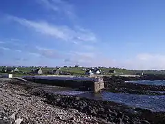 The pier at Portnaguran | |
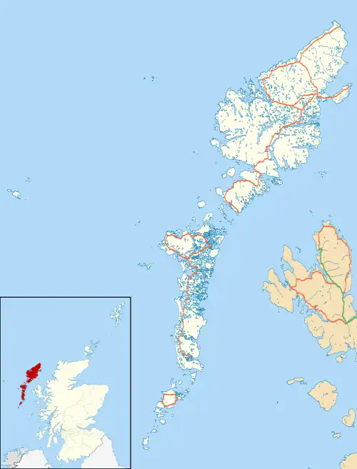 Portnaguran Location within the Outer Hebrides | |
| Language | Scottish Gaelic English |
| OS grid reference | NB558373 |
| Civil parish | |
| Council area | |
| Lieutenancy area | |
| Country | Scotland |
| Sovereign state | United Kingdom |
| Post town | ISLE OF LEWIS |
| Postcode district | HS2 |
| Dialling code | 01851 |
| Police | Scotland |
| Fire | Scottish |
| Ambulance | Scottish |
| UK Parliament | |
| Scottish Parliament | |
Portnaguran (Scottish Gaelic: Port nan Giùran) is a settlement situated within Point, on the Isle of Lewis, in the Outer Hebrides, Scotland. Portnaguran is the township at the north-easternmost point of the peninsula. It lies 1 mile (1.6 km) southwest of Tiumpan Head and just south of the headland called Geòdha 'ic Sheòrais or sometimes Small Head amongst locals. Portnaguran is situated at the north-eastern end of the A866,[1] within the parish of Stornoway.[2]
There is a small pier in the harbour,[3] and the surrounding villages are Portvoller, Broker, Aird and Flesherin. The village itself is about 12 miles (20 km) from the town of Stornoway.
References
- ↑ "A866". Sabre. Retrieved 20 December 2014.
- ↑ "Lewis, Portnaguran". Royal Commission on the Ancient and Historical Monuments of Scotland. Retrieved 20 December 2014.
- ↑ "Lewis, Portnaguran, Pier". Royal Commission on the Ancient and Historical Monuments of Scotland. Retrieved 20 December 2014.
External links
Wikimedia Commons has media related to Portnaguran.
- Canmore - Rambler: Port Nan Giuran, Lewis, North Minch site record
- Ports and Harbours of the UK - Portnaguran
| Inhabited islands | ||
|---|---|---|
| Other islands | ||
| Settlements |
| |
| Districts | ||
| Geographical features | ||
| Historical sites | ||
This article is issued from Wikipedia. The text is licensed under Creative Commons - Attribution - Sharealike. Additional terms may apply for the media files.