08°16′08″S 72°44′38″W / 8.26889°S 72.74389°W
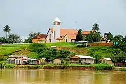
Porto Walter | |
|---|---|
 | |
 Flag | |
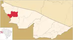 Location of municipality in Acre State | |
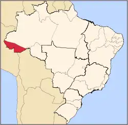
 Porto Walter Location in Brazil | |
| Coordinates: 08°16′08″S 72°44′38″W / 8.26889°S 72.74389°W | |
| Country | |
| State | Acre |
| Government | |
| • Mayor | Zezinho Barbary (PMDB) |
| Area | |
| • Total | 2,369 sq mi (6,136 km2) |
| Population (2020 est [1]) | |
| • Total | 12,241 |
| Time zone | UTC−5 (ACT) |
Porto Walter ([ˈpoʁtu ˈwawteʁ] or [ˈvawteʁ]) is a municipality located in the west of the Brazilian state of Acre. Its population is 12,241 and its area is 6,136 km².
The municipality contains 27% of the 846,633 hectares (2,092,080 acres) Serra do Divisor National Park, created in 1989.[2]
References
- ↑ IBGE 2020
- ↑ PARNA da Serra do Divisor (in Portuguese), ISA: Instituto Socioambiental, retrieved 2016-08-08
This article is issued from Wikipedia. The text is licensed under Creative Commons - Attribution - Sharealike. Additional terms may apply for the media files.