Queens Community District 6
Queens Community Board 6 | |
|---|---|
| Country | |
| State | |
| City | |
| Borough | |
| Neighborhoods | |
| Government | |
| • Type | Community board |
| • Body | Queens Community Board 6 |
| • Chairperson | Joseph C. Hennessy |
| • District Manager | Frank P. Gulluscio |
| Area | |
| • Total | 3.0 sq mi (8 km2) |
| Population (2016) | |
| • Total | 114,637 |
| • Density | 38,000/sq mi (15,000/km2) |
| Ethnicity | |
| • African-American | 2.9% |
| • Asian | 27.2% |
| • Hispanic and Latino Americans | 15.7% |
| • White | 51.2% |
| • Others | 3.1% |
| Time zone | UTC−5 (Eastern) |
| • Summer (DST) | UTC−4 (EDT) |
| ZIP codes | 11374, and 11375 |
| Area codes | 718, 347, and 929, and 917 |
| Police Precincts | 112th (website) |
| Website | www1 |
| [1] [2] | |
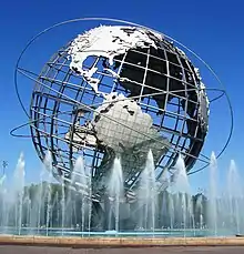
The Queens Community Board 6 is the local government body in the New York City borough of Queens, encompassing the neighborhoods of Forest Hills and Rego Park.[3] It is delimited by the Horace Harding Expressway to the north, Woodhaven Boulevard to the west, the Jackie Robinson Parkway to the south, and the Grand Central Parkway on the east.
References
- ↑ "NYC Planning | Community Profiles". communityprofiles.planning.nyc.gov. Retrieved August 9, 2019.
- ↑ "Queens Community District 6 profile.pdf" (PDF). docs.google.com. NYC Department of Planning. Retrieved August 9, 2019.
- ↑ Queens Community Boards, New York City. Accessed September 3, 2007.
External links
| ||||||||
This article is issued from Wikipedia. The text is licensed under Creative Commons - Attribution - Sharealike. Additional terms may apply for the media files.