 | ||||
|---|---|---|---|---|
| Bóthar R567 | ||||
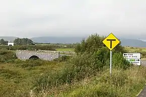 Approaching junction with R566 | ||||
| Route information | ||||
| Length | 5.9 km[1][2] (3.7 mi) | |||
| Major junctions | ||||
| From | ||||
| To | ||||
| Location | ||||
| Country | Ireland | |||
| Highway system | ||||
| ||||
The R567 road is a regional road in Ireland. It is a road on the Iveragh Peninsula in County Kerry.[1][2] The road is part of the Wild Atlantic Way.[3] Parts of the road form part of the Emlagh Loop walking trail.[4]
The R567 travels west from the N70 to terminate at the R566 at Emlaghmore Bridge. The R567 is 5.9 km (3.7 mi) long.[1]
References
- 1 2 3 Google (16 May 2016). "Ring of Kerry to R566" (Map). Google Maps. Google. Retrieved 16 May 2016.
- 1 2 "S.I. No. 54/2012 – Roads Act 1993 (Classification of Regional Roads) Order 2012". Government of Ireland. 28 February 2012. Retrieved 16 May 2016.
- ↑ "Wild Atlantic Way: Explore The Route". Fáilte Ireland. Retrieved 16 May 2016.
- ↑ "Emlagh Loop". Tourism Ireland. Retrieved 1 June 2016.
This article is issued from Wikipedia. The text is licensed under Creative Commons - Attribution - Sharealike. Additional terms may apply for the media files.