Rangersdorf | |
|---|---|
 Coat of arms | |
 Rangersdorf Location within Austria | |
| Coordinates: 46°52′N 12°58′E / 46.867°N 12.967°E | |
| Country | Austria |
| State | Carinthia |
| District | Spittal an der Drau |
| Government | |
| • Mayor | Franz Zlöbl |
| Area | |
| • Total | 84.27 km2 (32.54 sq mi) |
| Elevation | 864 m (2,835 ft) |
| Population (2018-01-01)[2] | |
| • Total | 1,736 |
| • Density | 21/km2 (53/sq mi) |
| Time zone | UTC+1 (CET) |
| • Summer (DST) | UTC+2 (CEST) |
| Postal code | 9833 |
| Area code | 04823 |
| Website | www.rangersdorf.at |
Rangersdorf is a town in the district of Spittal an der Drau in Carinthia, Austria.
Geography
Rangersdorf lies in the Möll valley (German: Mölltal) between the Goldberg Group of mountains to the north and the Kreuzeck Group to the south.
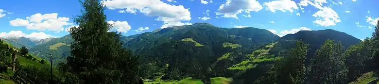
Looking across the Möll Valley from Rangersdorf
References
- ↑ "Dauersiedlungsraum der Gemeinden Politischen Bezirke und Bundesländer - Gebietsstand 1.1.2018". Statistics Austria. Retrieved 10 March 2019.
- ↑ "Einwohnerzahl 1.1.2018 nach Gemeinden mit Status, Gebietsstand 1.1.2018". Statistics Austria. Retrieved 9 March 2019.
This article is issued from Wikipedia. The text is licensed under Creative Commons - Attribution - Sharealike. Additional terms may apply for the media files.