Reuth bei Erbendorf | |
|---|---|
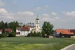 Reuth bei Erbendorf | |
 Coat of arms | |
Location of Reuth bei Erbendorf within Tirschenreuth district 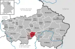 | |
 Reuth bei Erbendorf 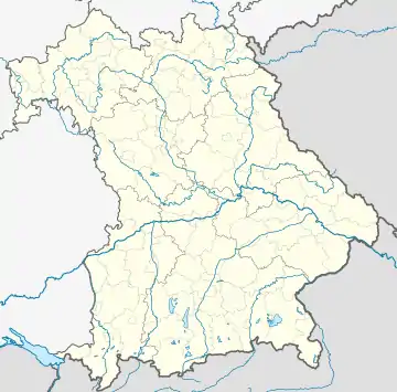 Reuth bei Erbendorf | |
| Coordinates: 49°51′N 12°7′E / 49.850°N 12.117°E | |
| Country | Germany |
| State | Bavaria |
| Admin. region | Oberpfalz |
| District | Tirschenreuth |
| Municipal assoc. | Krummennaab |
| Subdivisions | 15 Ortsteile |
| Government | |
| • Mayor (2020–26) | Werner Prucker[1] (FW) |
| Area | |
| • Total | 16.91 km2 (6.53 sq mi) |
| Elevation | 476 m (1,562 ft) |
| Population (2022-12-31)[2] | |
| • Total | 1,098 |
| • Density | 65/km2 (170/sq mi) |
| Time zone | UTC+01:00 (CET) |
| • Summer (DST) | UTC+02:00 (CEST) |
| Postal codes | 92717 |
| Dialling codes | 09681, 09682, 09683 |
| Vehicle registration | TIR |
| Website | https://www.reuth-b-erb.de/ |
Reuth bei Erbendorf is a municipality in the district of Tirschenreuth in Bavaria, Germany.
References
- ↑ Liste der ersten Bürgermeister/Oberbürgermeister in kreisangehörigen Gemeinden, Bayerisches Landesamt für Statistik, 15 July 2021.
- ↑ Genesis Online-Datenbank des Bayerischen Landesamtes für Statistik Tabelle 12411-003r Fortschreibung des Bevölkerungsstandes: Gemeinden, Stichtag (Einwohnerzahlen auf Grundlage des Zensus 2011)
Towns and municipalities in Tirschenreuth (district) | ||
|---|---|---|
This article is issued from Wikipedia. The text is licensed under Creative Commons - Attribution - Sharealike. Additional terms may apply for the media files.