| Tat | |
|---|---|
 | |
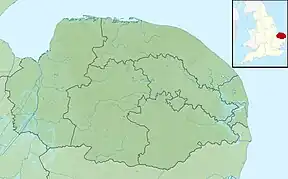 Location of the river mouth within Norfolk | |
| Location | |
| Country | England |
| Region | Norfolk |
| Physical characteristics | |
| Source | Syderstone Common |
| • location | Tattersett |
| • coordinates | 52°50′51″N 0°43′31″E / 52.8476°N 0.7252°E |
| • elevation | 48 m (157 ft) |
| Mouth | River Wensum |
• location | Tatterford |
• coordinates | 52°49′02″N 0°46′55″E / 52.8171°N 0.7820°E |
• elevation | 39 m (128 ft) |
| Length | 7.2 km (4.5 mi) |
| Basin features | |
| River system | River Wensum |
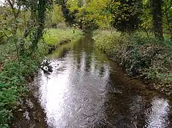
The River Tat is a short river in the County of Norfolk, England. It is an important headwater for the River Wensum of which it is a tributary. Its source is on Syderstone Common, just north of the village of Tattersett. The marshes and pools of Syderstone Common that provide the headwaters for the river are a site of special scientific interest (SSSI) and are the home of a viable colony of the rare Natterjack Toad.[1]
References
This article is issued from Wikipedia. The text is licensed under Creative Commons - Attribution - Sharealike. Additional terms may apply for the media files.